PCT Sierra City to Drakesbad, 2018
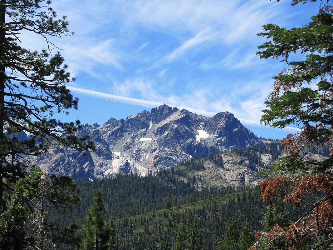
Sierra Buttes View: The start our 12-day 160-mile trek
On our first day we were treated to clear views of the Sierra Buttes. The itty-bitty point on the highest peak is the fire lookout tower, one of our destinations for the next day.
NOTE: Map of our route showing where we camped is on the last slide
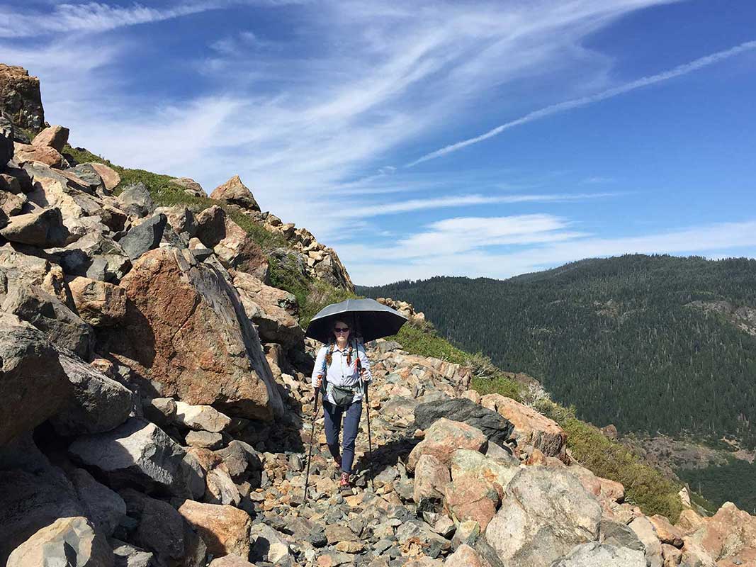
How to walk in the heat of the afternoon
We did this lower-elevation (3,000 - 7,500 feet) trip in mid-July and temperatures reached almost 100°F every day. Thankfully we brought our super-lightweight reflective trekking umbrellas and we've figured out a way we can attach them to our pack straps (using gear-ties) and walk hands-free.
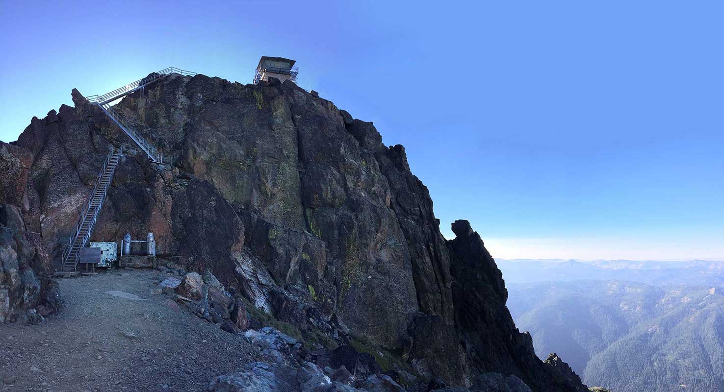
Sierra Buttes Fire Lookout
A benefit of section hiking is taking side trips (thru-hikers often don’t) and we added a 3-mile round trip with 1200’ of climbing to visit the Sierra Buttes Fire Lookout, The now retired lookout is reached via 178 stairs and is rimmed with steel mesh walkways that let you see straight through to the 600’ drop below (and yes, I have a fear of heights).
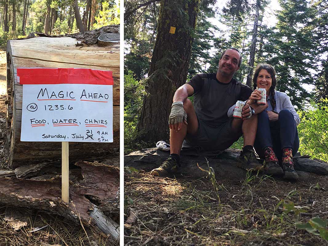
Trail Magic!
A highlight of our 4th day was a trail magic experience at Quincy-LaPorte Road from a Sacramento woman who drives up every weekend with the goal of supplying every hiker with 1000 calories of food (she seemed disappointed that only 38 hikers had come through that day - down from the peak). She had homemade turkey roll-ups (and veggie roll-ups for non-meat eaters), cheese-quesadillas, brownies, lemonade and cold beer, also first aid supplies including Leukotape. We were already carrying all the food we could eat and were so close to camp for the night, we passed on her food but gladly accepted 2 cold beers (even if they were Budweiser) which we happily drank in camp (and carried the empty cans out, of course!)
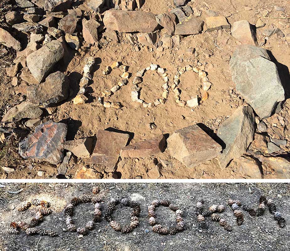
PCT "milestones"
PCT hikers love to recognize their accomplishments and you encounter unofficial milestone markers like these in the non-National Park sections of the trail. We passed the 1200 mile marker on our first day and I was pleased to pass this 2000 KM marker on our 5th day, created by our more civilized metric country fellow hikers.
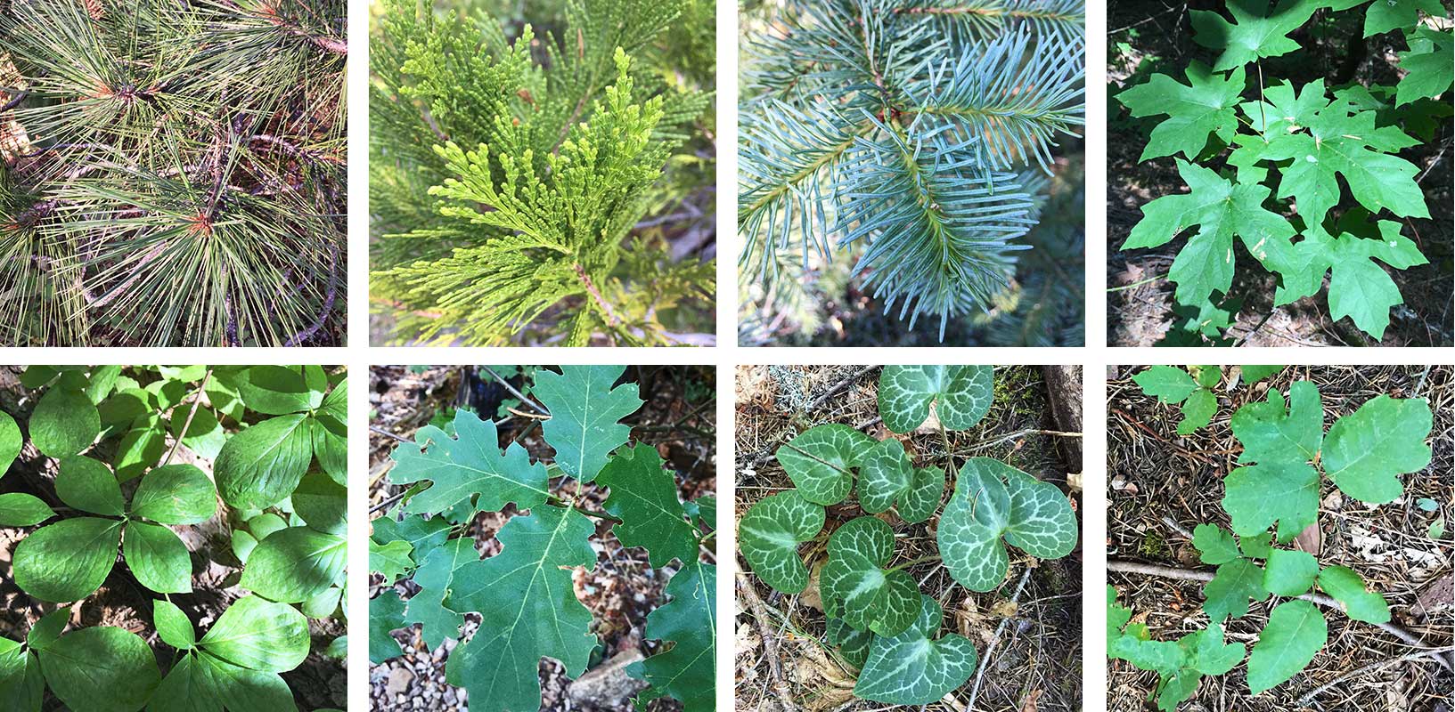
Portraits of trees at different elevations
As we descended from 7,000' to 3,000', we hiked through different flora zones and I took portraits of the leaves as a way to stay present in the environment instead of focusing on the long, knee-punishing descent (we descended a total of 5,200' that day). Pines, cedars and firs at the higher elevations, then maples, dogwoods, and oaks, then wild ginger and finally, everyone's favorite, poison oak. Although I loved our time at the middle fork of the Feather River, I couldn't wait to get above 5,000' again to be out of the poison oak zone - it lined the trail for miles.
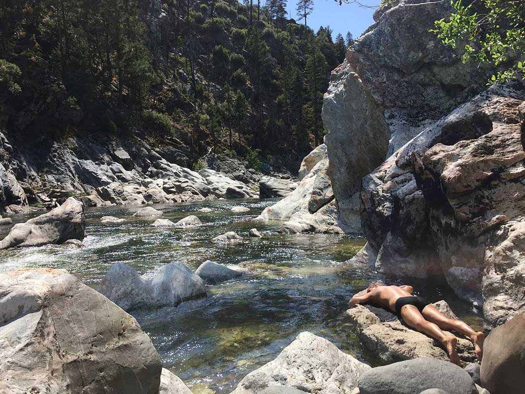
Relaxing on the Middle Fork of the Feather River
Our reward for our 5,200' descent was a chance to swim and relax by the Feather River - what a treat it was. Rob is demonstrating how to take a nap in the sun by the river. We waited out the hottest part of the day there and then climbed up 1000' to our camp for the night.
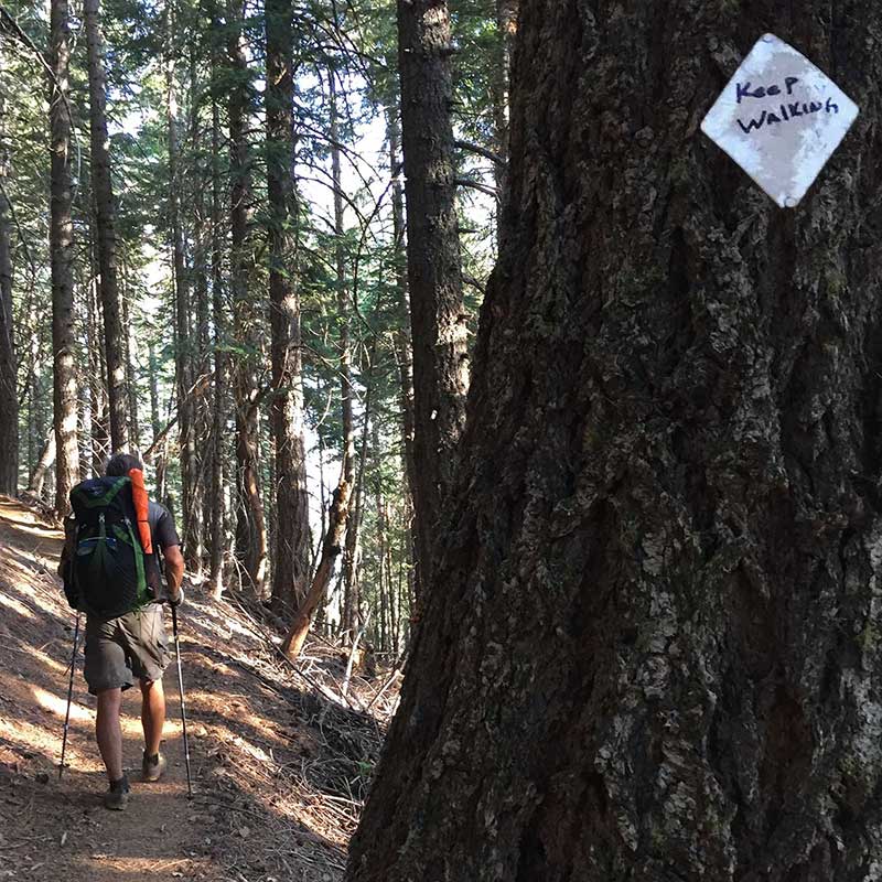
Words of encouragement
The next day was a long ascent (almost 5,000') and we started noticing that someone had written words of encouragement such as "Don't worry, be happy" and "Keep walking" on the PCT trail blazes on the trees.
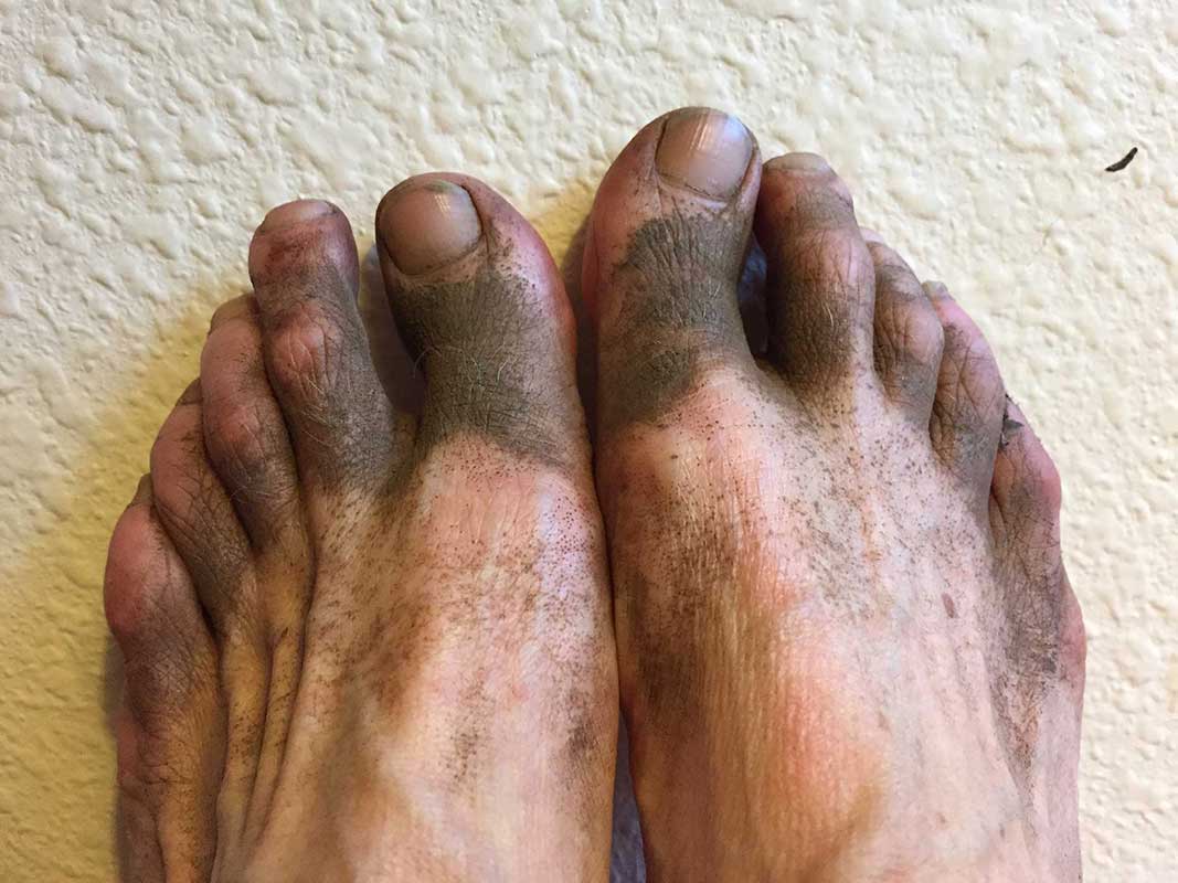
Will my feet ever be clean again?
This section hike of the PCT was the dirtiest we've experienced so far. I wear trail runners with mesh uppers and the dirt just sifts through the mesh and my socks to land on my feet. We also had to dry-camp a lot on this trip, leaving me with no way to wash my feet before going to sleep. You either learn to become one with the dirt or go crazy, so I chose the former but I never did get to the point of liking it. I was so looking forward to a shower on our 6th day, during our re-supply break at Bucks Lake.
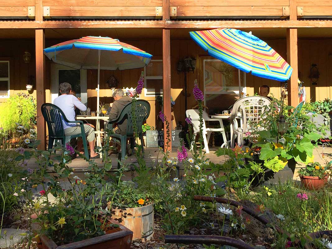
Breakfast at the Haskins Valley Inn
We picked up our resupply of food at Bucks Lake Resort and enjoyed a pleasant night's stay at the Haskins Valley Inn Bed & Breakfast - showers! real beds! delicious breakfast that someone else cooked for us! And a beautiful flower garden too.
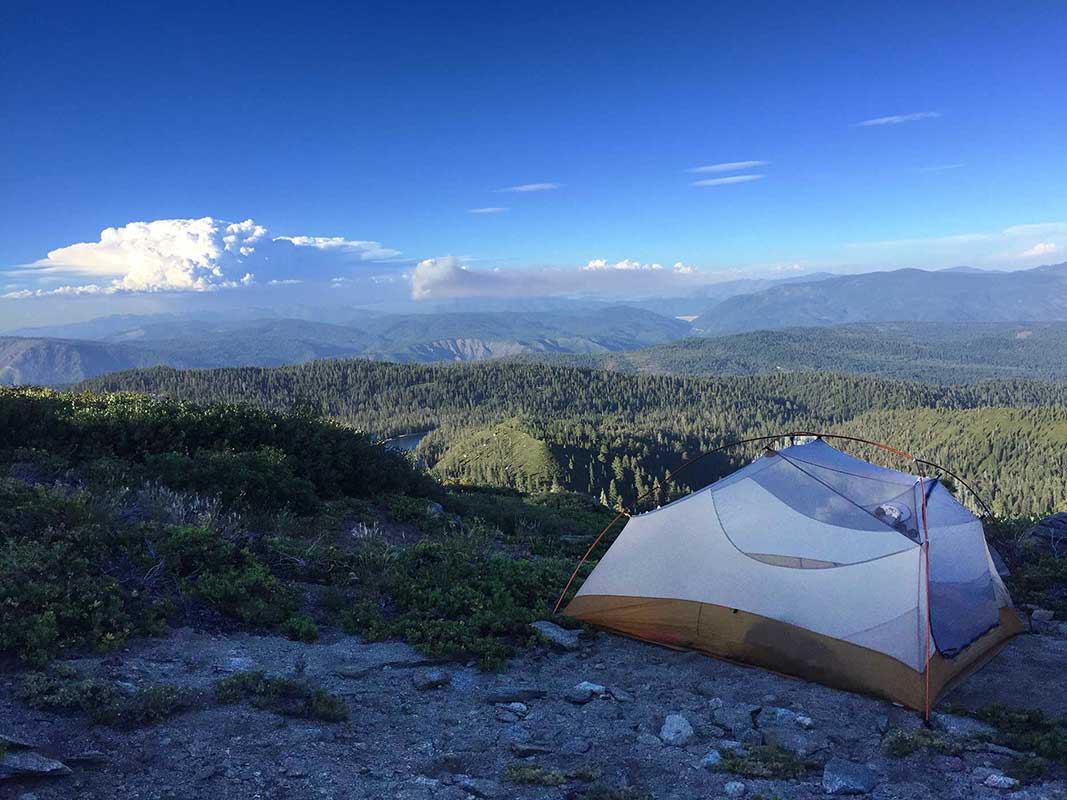
Ridge line campsite with pyrocumulus cloud from the Roxie Fire
On Day 7 we left Bucks Lake after lunch and hiked up to this incredible view campsite on a ridge, overlooking Silver Lake in the Bucks Lakes Wilderness. An ominous pyrocumulus cloud had formed above the next ridge (to the left, you can see the smoke from the Roxie fire, west of Susanville), a foreshadow of the days to come. You might be wondering how I knew the name of the fire and where it was located. Well...we had cell service at many points along our trip with 3 bars of LTE here so I could check the Cal Fire map on GoogleMaps!
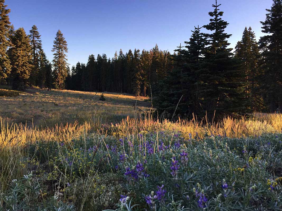
Dawn in Meadow
On our 8th day we walked through several pleasant meadows including this lupine filled one we saw early in the morning just as the sun was rising.
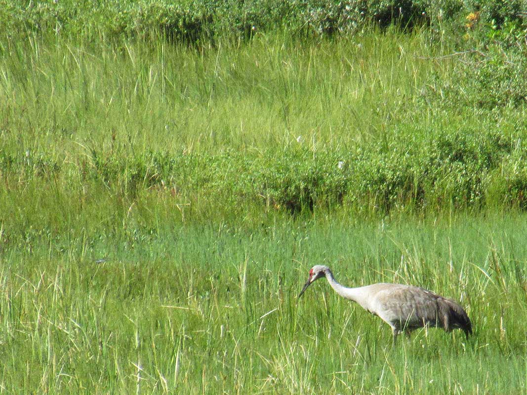
Sand Hill Crane
We had a few great wildlife sightings on this trip including this Sand Hill crane in a meadow. I took this photo with my little pocket Canon SX620 with a 25x optical zoom lens.
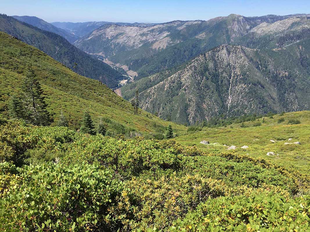
Another punishing descent to the Feather River & Belden Town
This section of the PCT traverses the Feather River watershed, taking you up or down 5,000-6,000 feet in a day - a brutal combination with hot temperatures and no shade. This was a view of our descent to the small industrial town of Belden where we spent an afternoon waiting out the hottest part of the day by swimming in the river and hanging out with other hikers in the local bar, having beers and an early dinner.
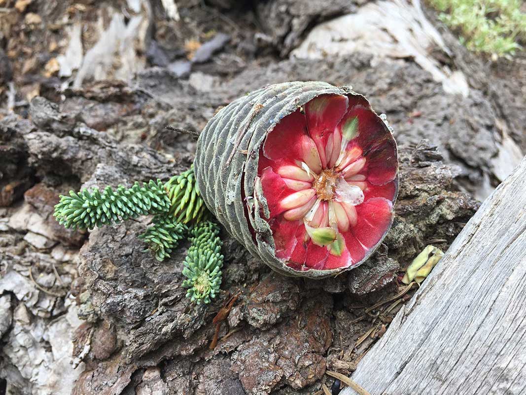
Fir cone
On our 9th day, I came across this exquisite partially eaten unripe fir cone, perhaps harvested and abandoned by a squirrel.
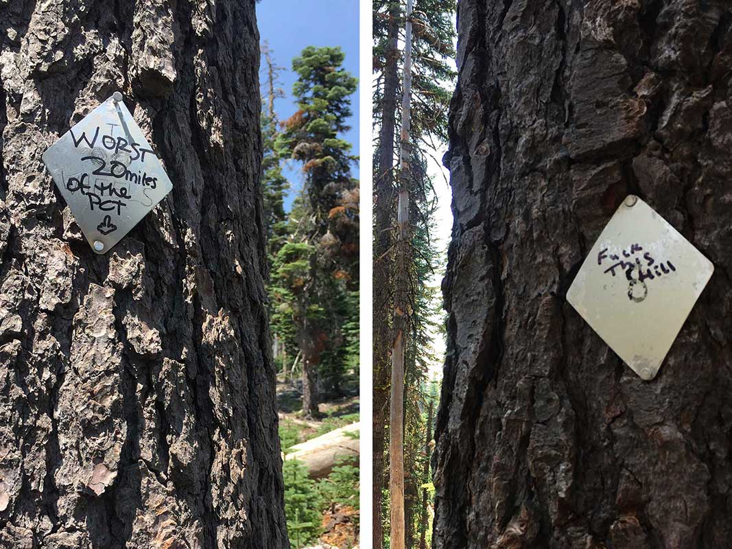
Hill hating: from words of inspiration to words of despair
On day 9 of our trip, we ascended 5,700’ and descended 1650’ in 16.5 miles. The day was, in a word, brutal. The unrelenting climb was reflected in the messages written on the trail blazes - inspirational quotes had turned to despair and anger.
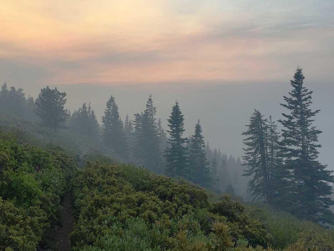
Smoky sunrise
Ever since we saw the pyrocumulus cloud 4 days earlier, the air on each day became more and more smoky until we woke up to this. Yikes!
Midpoint Marker of the PCT
Click the play button to see an animation of us at the PCT midpoint marker on the 11th day of our trip - halfway between Mexico and Canada in trail miles - yay! Because the air was so thick with smoke, we wore our Buffs quadruple folded and soaked in water to try to avoid breathing in as much of the smoke particles as we could.
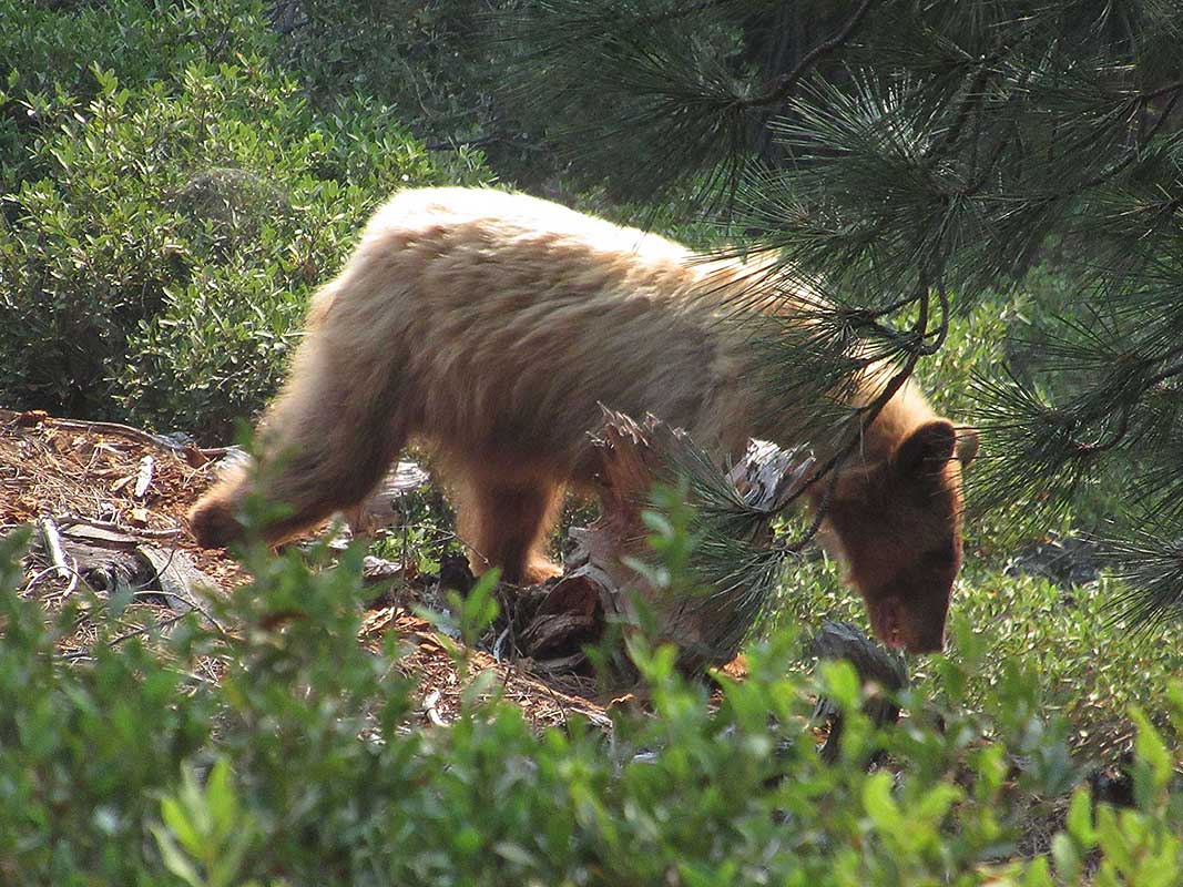
Bear sighting
Just after breakfast on the final day of our trip, we saw this beautiful shaggy blonde colored black bear. She was with a cub and we kept our distance from them and watched as they moved slowly down the hillside. The mama bear seemed unconcerned we were there - a sign of a bear that's habituated to people (not good) - unlike a bear we encountered several days earlier who took off running the moment it saw us.
Terminal Geyser
Our trip ended in Lassen Volcanic National Park and we took the 0.6 mile side trip to see Terminal Geyser, well worth the trip. Click the play button to see lots of steam and a stream of boiling water - not exactly the kind of hot springs you want to jump into. But luckily we were able to enjoy the hot springs pool and showers at Drakesbad Ranch when we finished our hike later that day.
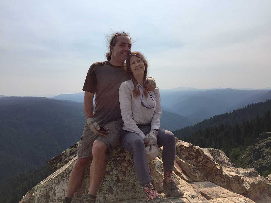
Dirty, Smelly, Tired and Happy
We did it! And we're still happy with each other and really looking forward to next year's backpacking adventures!
There's a map of our trip in the next slide.
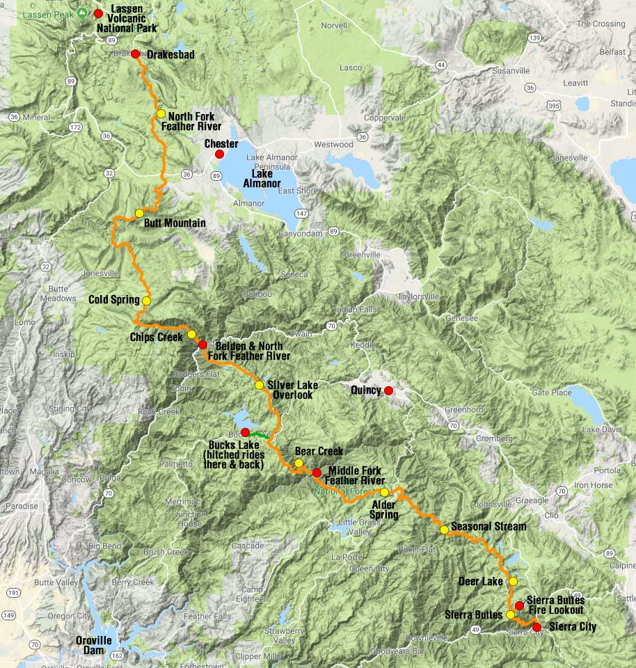
Map of where we hiked and camped
PCT Section hike from Sierra City (mile 1195.4) to Drakesbad (mile 1350) with several side trips
Red dots show points of interest and yellow dots showed where we camped. Orange marks where we hiked and green shows where we hitched rides.