PCT Section through Southern Washington, July 31 - August 17, 2022
From July 31 – August 17, 2022, we hiked a 246-mile section of the Pacific Crest Trail through Southern Washington State. We were on trail for 17 days, 4 half-days and 13 full-days, averaging 9 miles a day on half-days and 16-miles a day on full-days. Over the 17 days, we ascended a total of 45,989 feet and descended 43,351 feet.
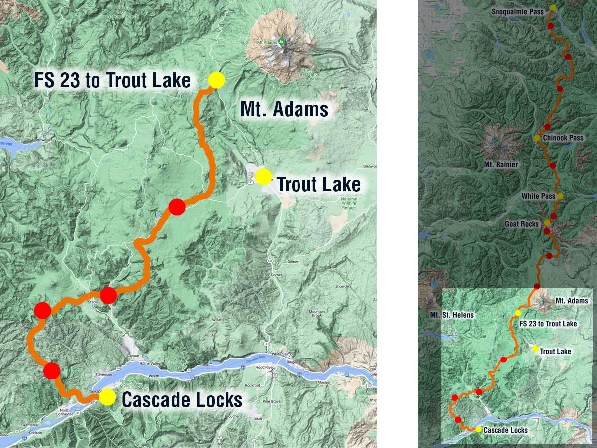
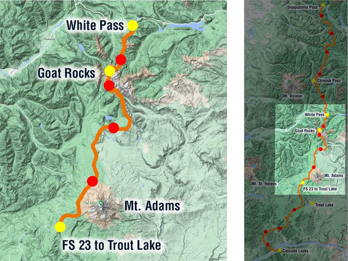
Map of PCT-section hike from Cascade Locks to Snoqualmie Pass, Part 1
Our trip was divided into 3 sections based on where we would pick up resupply packages. Part 1 took us north from Cascade Locks on the Oregon-Washington border to the sweet town of Trout Lake where we resupplied and took a zero (mile) day.
Bridge of the Gods
Our trip got off to an exciting start by crossing The Bridge of the Gods across the Columbia River. The bridge does not have a pedestrian or bike lane, you must walk facing traffic and hope the drivers see you. Luckily the speed limit is 5 mph and if you watch the video above you can see that traffic was light so it felt safe. I wasn’t sure how my fear of heights would deal with seeing the Columbia River far down below, but I did fine.
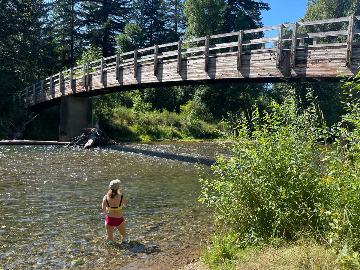
Cooling Down in the River
It was 99°F the day we left Cascade Locks and the heat wave continued several days into our trip, so we took the opportunity to cool off whenever we could; we had three heat waves during our trip with temperatures in the high 90s farenheit.
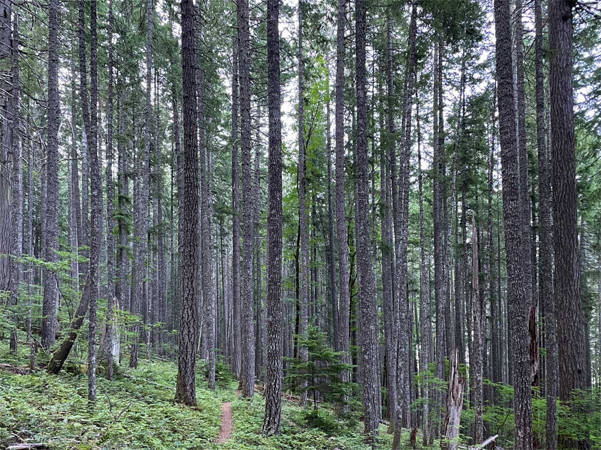
Miles of forest
We spent many miles on our trip hiking through forest, sometimes beautiful cool shady old growth lodgepoles like this, other times sparse second growth, clear cut, or burn zones.
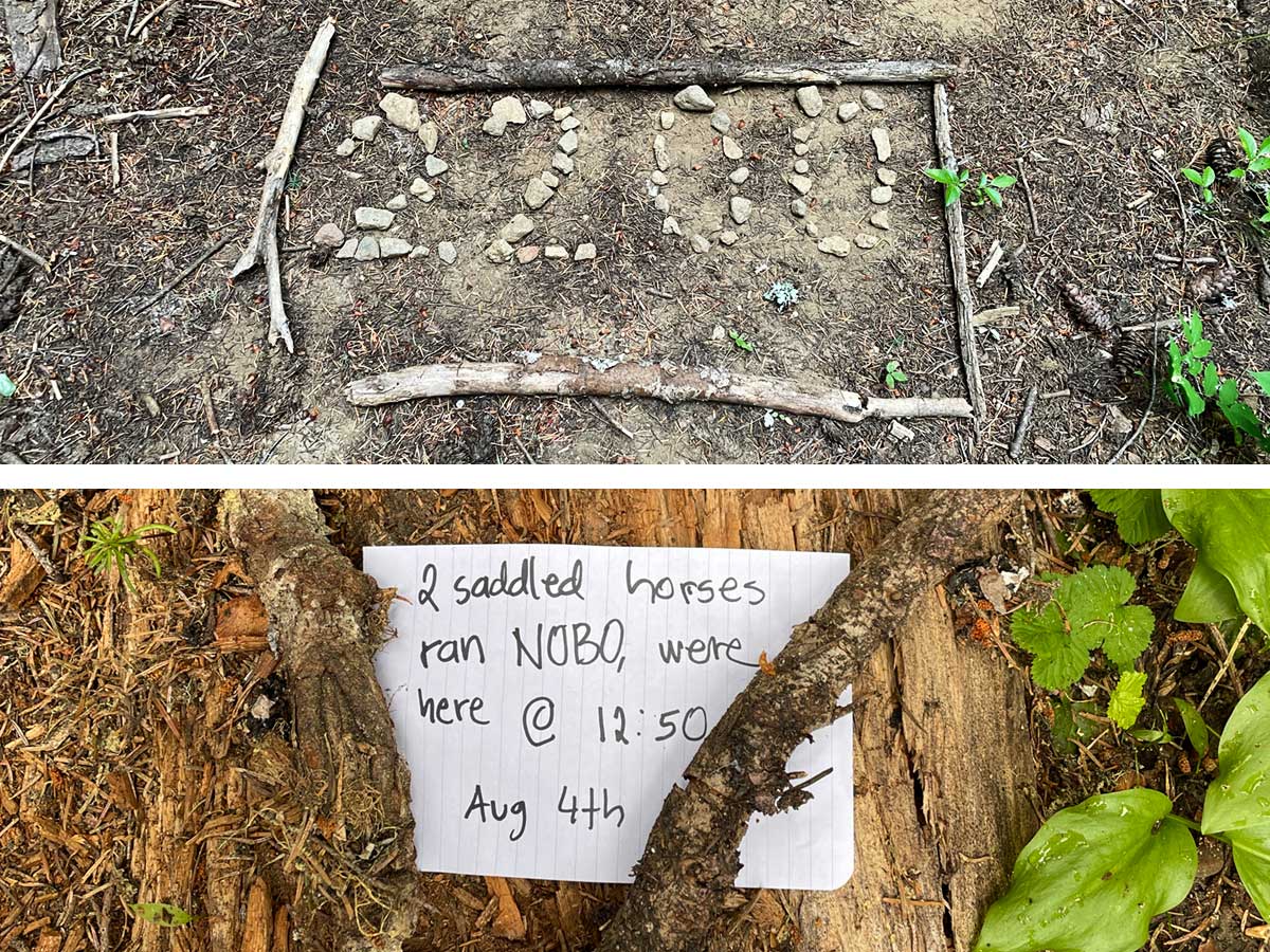
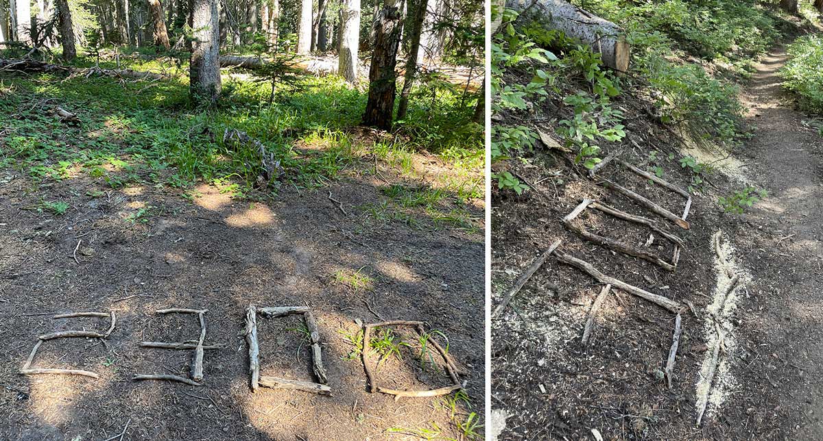
Notes along the trail
[Top] On day 5 of our trip, we passed the informal 2200-mile mark in the trail – only 450 more miles to Canada! And we also saw the most unusual note we encountered along the trail [Bottom]. Hikers will sometimes leave notes for other hikers and we were puzzled by this one. Was “2-saddled horses” a clever trail name for someone or had 2-saddled horses actually run by north bound (NOBO) at 12:50 pm? As we walked on, we started tracking hoof prints on the trail but after a mile or so, the tracks disappeared. We later caught up with the hikers who left the note and learned they encountered the horse owners: two guys were fishing by a lake below when their horses got spooked by the mosquitos and ran off; we’ll never know if the horses were found. I'm really glad we never encountered the running horses on the trail because it was narrow and there were few places to step aside.
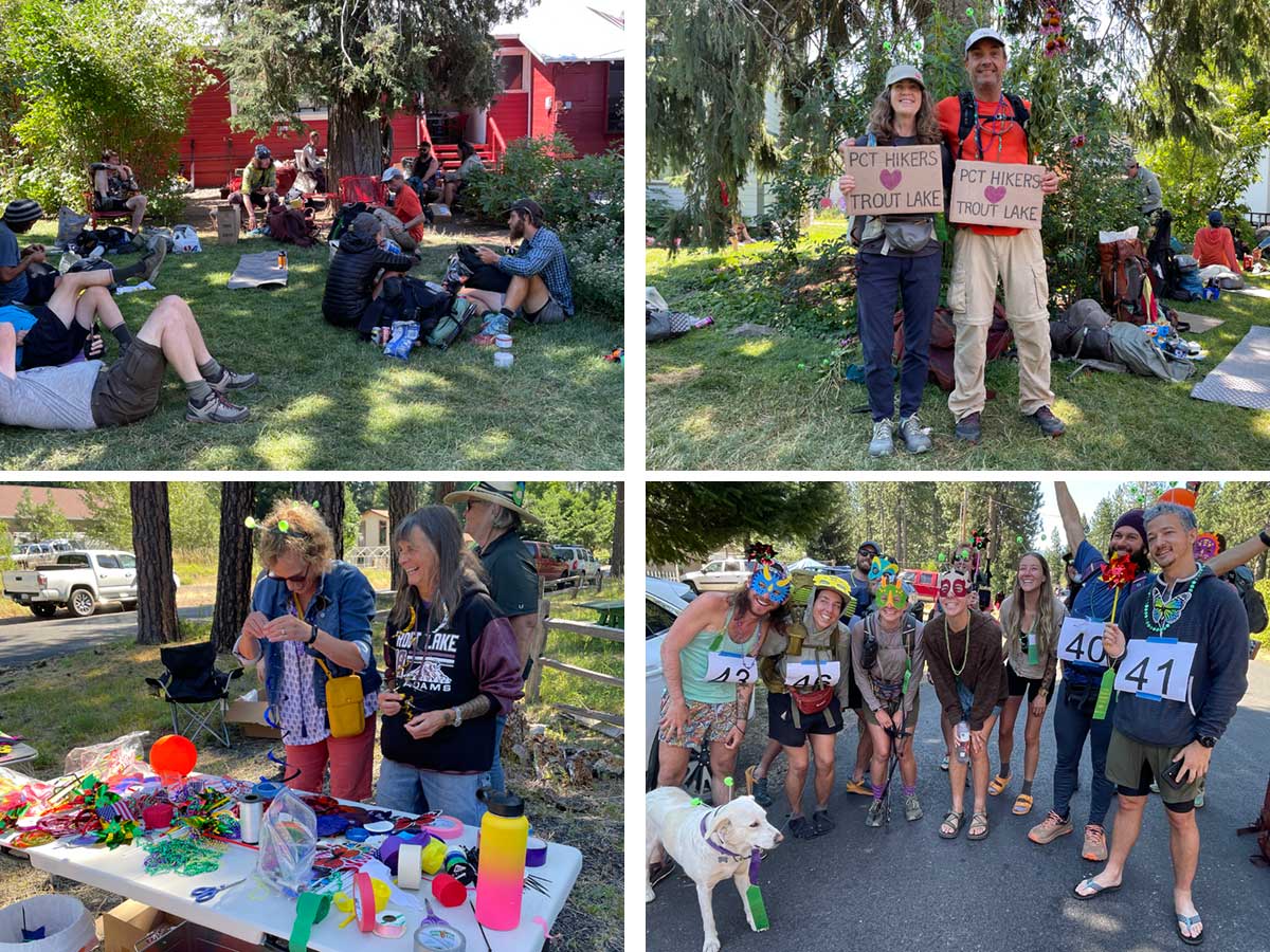
Trout Lake Fair and Parade
On day 6 of our trip, we arrived in Trout Lake, a PCT-loving town about 20-miles from the trail. The Trout Lake Store (upper left) has a large lawn area with picnic tables and shade where hikers hang out all day, airing out their gear, charging devices and resupplying. We happened to arrive on the same weekend as the annual Trout Lake Fair and hikers were invited to march in their parade, so we made signs (top right). They had a “bling” table (lower left) where everyone was invited to decorate themselves with beads, streamers, headbands, and masks. At first Rob and I thought we would be the only hikers in the parade but we ended up with a happy and enthusiastic group (lower right). All of this small-town fun made this stop a highlight of our trip.
Part 2: Map of PCT-section hike
On the second part of our trip we traveled north from Trout Lake, around the western flanks of Mt Adams, then through the stunning Goat Rocks Wilderness to resupply at White Pass.
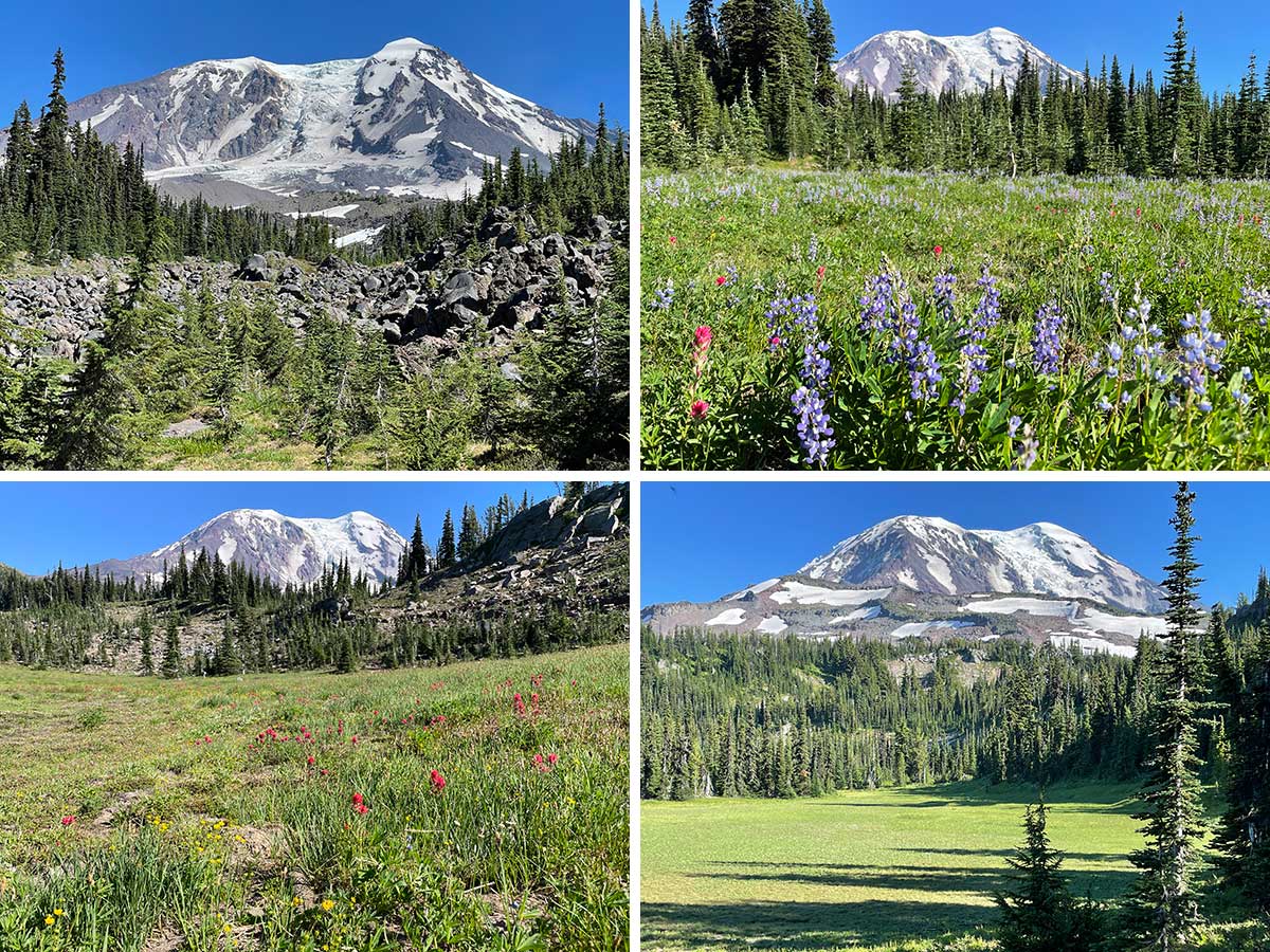
The many faces of Mt. Adams
As we walked north around the west side of Mt. Adams, we got a variety of different views.
Crossing Adams Creek
This video shows our first and only challenging creek crossing of the trip.
Morning View Mt. Adams
As we walked through forest most of the time, sublime views like this were few and far between, especially during the golden morning and evening hours.
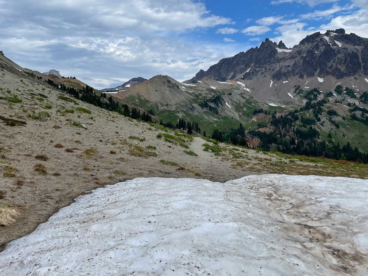
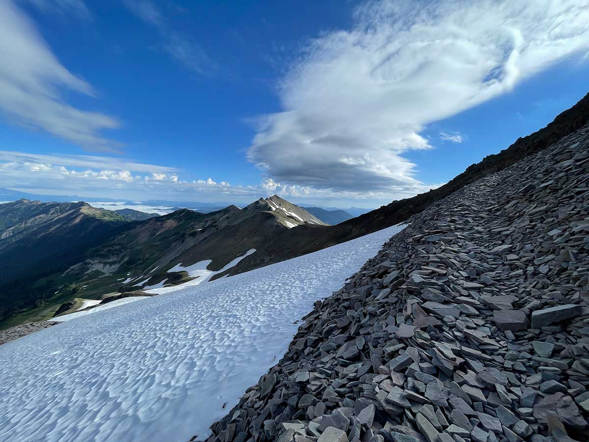
Goat Rocks and Cispus Pass
We encountered our first patch of snow on our way to Cispus Pass (6473 ft) where we entered the heart of Goat Rocks wilderness, the highlight of our trip. Cispus Pass is the first saddle from the left, with a little band of snow below it.
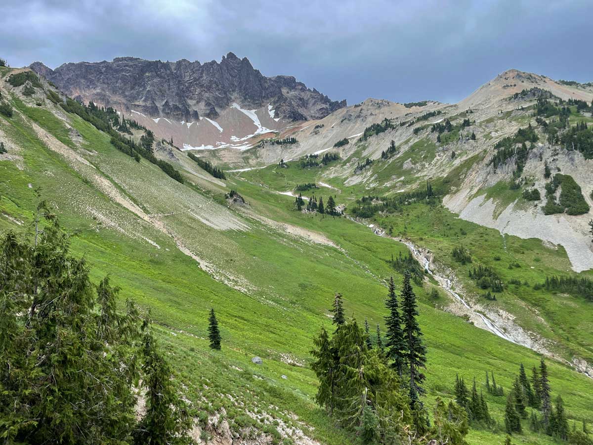
Goat Rocks Greenery
The terrain of Goat Rocks Wilderness reminded us of the high Sierra and we felt right at home.
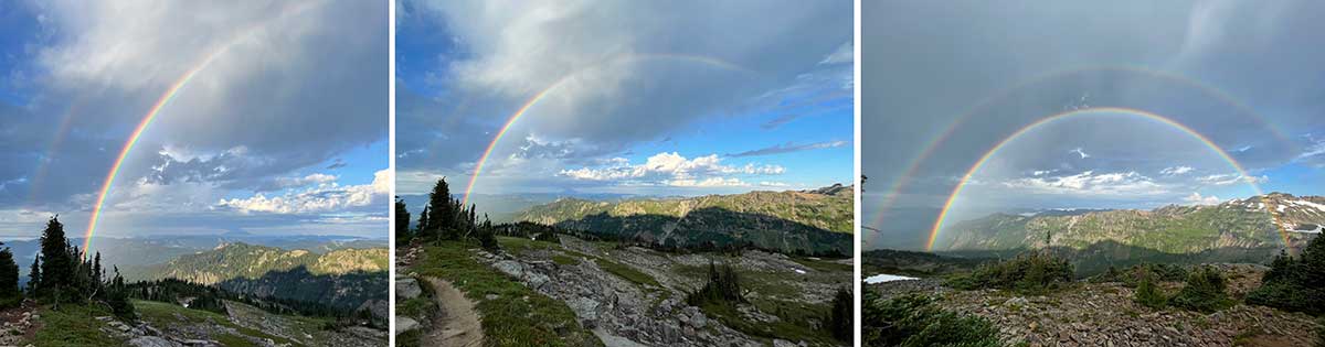
Double Rainbow
On the day we were to hike the infamous exposed knife-edge ridge of the PCT through Goat Rocks, the morning began with thunder and my heart sank. Big drops fell on us and we put on our rain gear. As we climbed higher, the most beautiful double rainbow appeared. Then I knew it was going to be a good day!
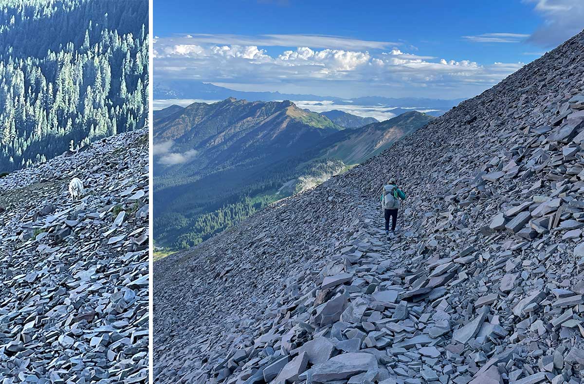
Taking the Original PCT Route vs. the Alternate
There are two options to begin the knife-edge trail, the original route of the PCT and the new alternate that avoids having to cross the Packwood Glacier. Rob is a "walk every footstep on the PCT" kind of guy so we took the original route, initially crossing this talus field where we saw our first mountain goat.
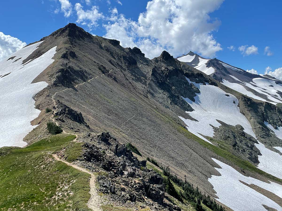
First View of the Knife-Edge Trail
As we carefully walked along the original PCT trail, we could see the full knife-edge trail in the distance along the left.
Kicking Steps
Eventually we encountered a long stretch of snow we had to cross. Several hikers behind us felt uncertain about crossing it because of the 1,000-foot runout below. This video shows Rob kicking secure steps for everyone as well as a view of where you would end up if you slid down.
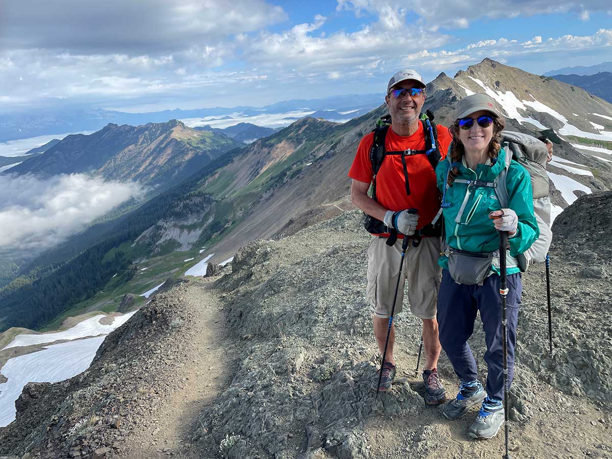
Happy
We were happy to reach the end of the original PCT route, thinking we had done the hardest part. Wrong.
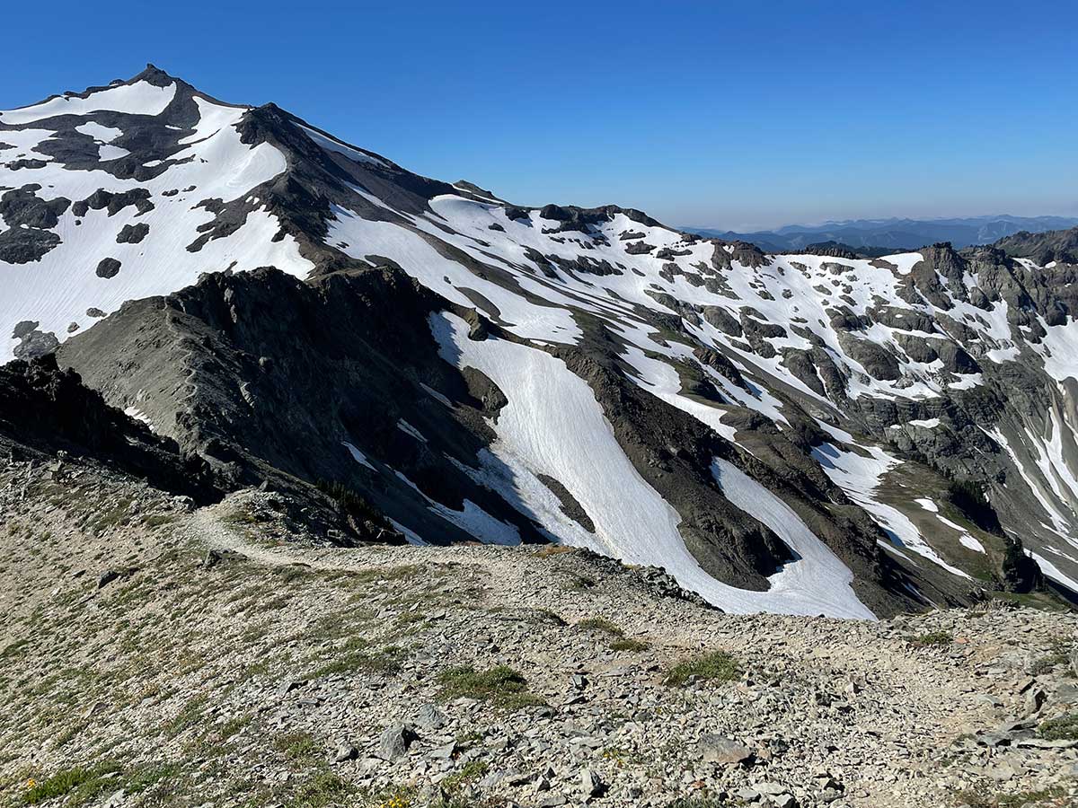
Looking back on the Knife-Edge Trail
Looking back on the trail: the snowfield we crossed near the middle and the trail zig-zagging down on the left
The Hardest Part of the Knife-edge Trail (for me)
Looking back on what was the hardest part of the trail for me: this traverse. At times the trail was loose talus and scree on sand that sloped down at an uncomfortable angle. Occasionally the trail had eroded away, and you were forced to take that big step over the abyss. Each step was a meditation in careful foot placement. I especially love all the goat trails you can see in the talus below the PCT.
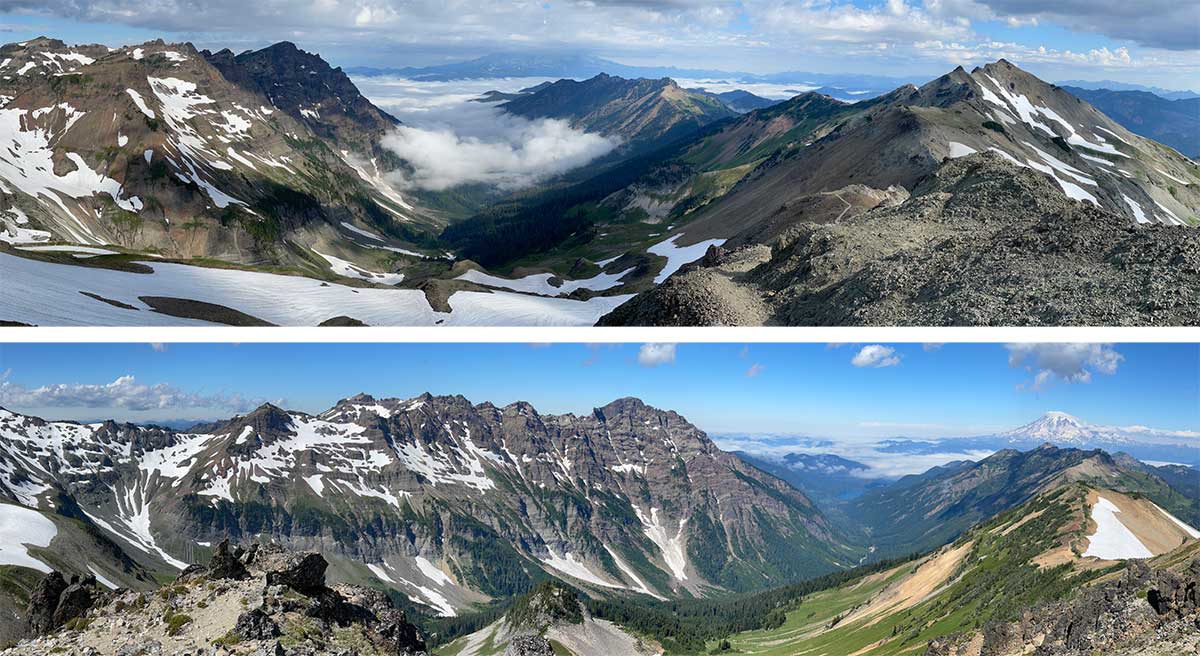
Panoramas of Goat Rocks Wilderness
The lingering clouds in the valleys below and the sight of Mt. Rainier enhanced the stunning views from the knife-edge ridge.
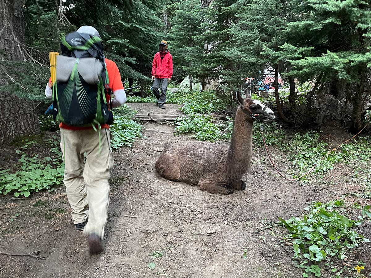
Passing a Llama on Our Way Out of Camp
We ended up sharing one of our campsites with a llama-packing group and had to walk around a resting llama when leaving camp in the morning. The llamas were very cute.
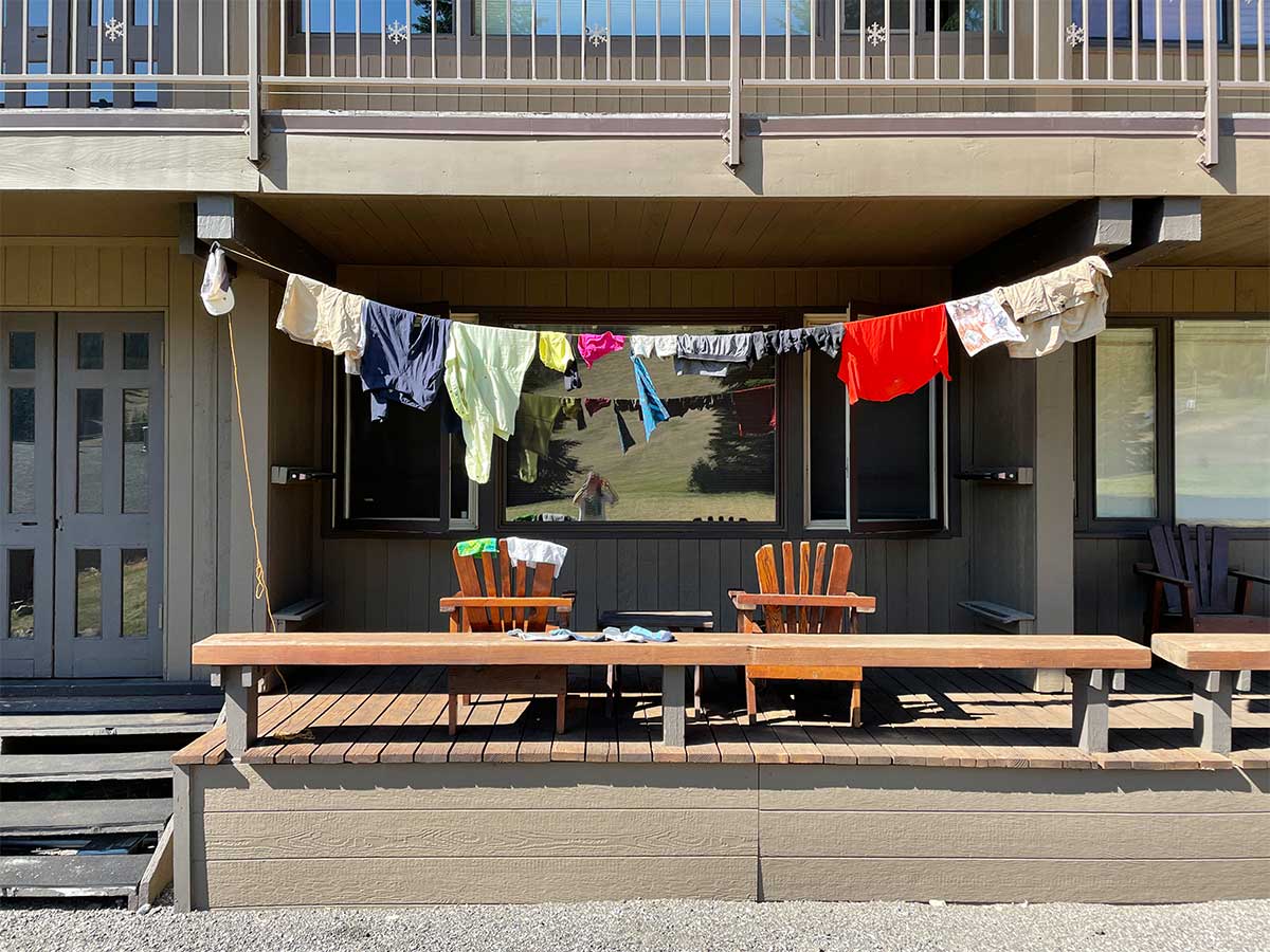
Laundry at White Pass
We spent an afternoon and overnight in White Pass to resupply, shower, and do laundry. There was a long waiting list to use the one washing machine at the local store so we ended up washing our laundry in the sink and hanging it to dry on the deck of the ski condo we rented for the night.
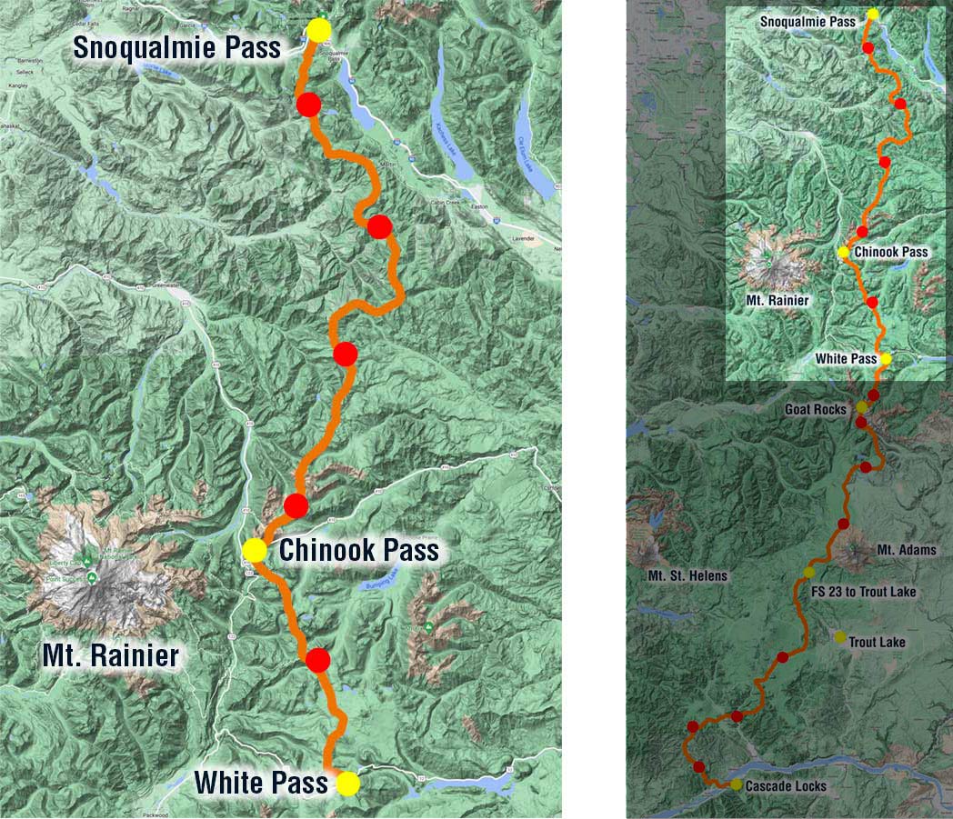
Part 3: Map of PCT-section hike
On the third and last part of our trip we traveled north from White Pass, around the eastern side of Mt. Rainier, through large burn zones, across Chinook Pass, the gateway to Mt. Rainier National Park, to end our trip at Snoqualmie Pass.
2300 Miles to Mexico and 300 Miles to Canada
Another 100-miles done: soon after leaving White Pass, we hiked past the informal trail marker for the 2300-mile mark: only 350-miles left to Canada! And 50-miles later, we hiked past the marker for 300-miles left to Canada!
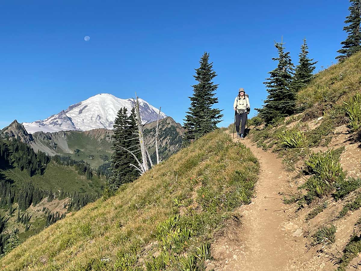
Mt. Rainier Felt So Close!
We got some great views of Mt. Rainier on this part of our trip, including this early morning view when the moon was still up.
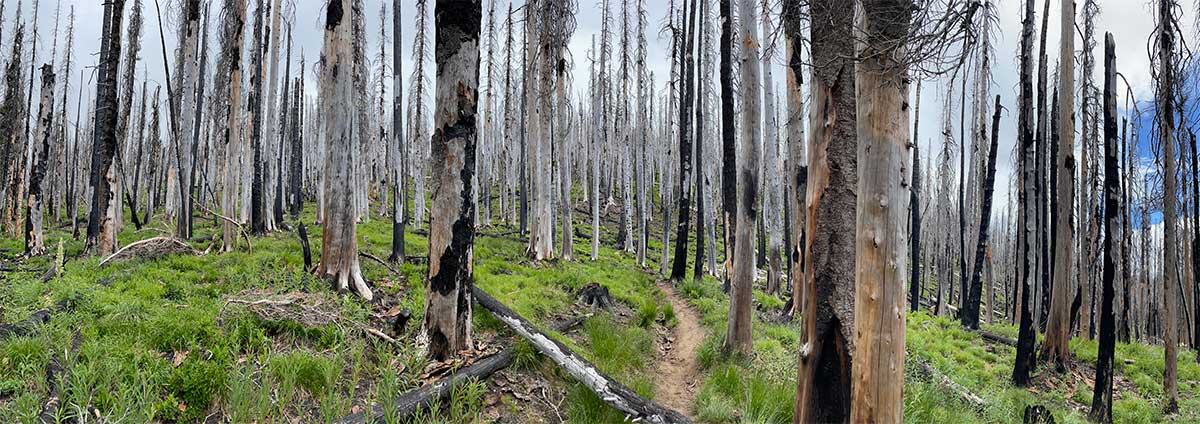
Large Burn Zone near Mt. Rainier
We hiked a long waterless stretch of trail (11.2-miles) through a large burn zone (8-miles of trail) that definitely turned down the mood-meter of our day.
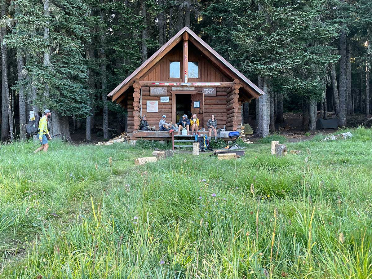
Mike Urich Cabin
It was a pleasant change to come across the Mike Urich Cabin along the trail. Built as a winter snowmobiling cabin on a large meadow, we enjoyed hanging out on the porch with other hikers as we cooked our dinner. We were also happy to find that someone had left a cooler of Trail Magic inside the cabin, stocked with Rainier Beer and bags of chips. My hiker-hunger had set in by then and it tasted so good.
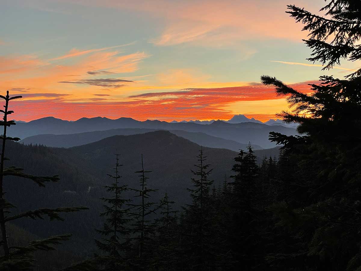
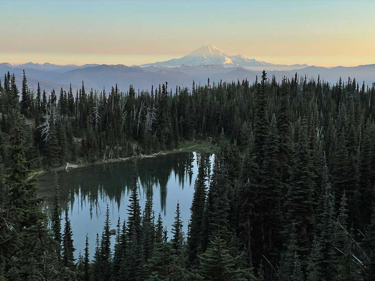
Sunrise in the Cascades
It was rare to have a campsite with a view where we could enjoy a sunrise like this so I was happy to experience it on one of our last days on the trail.
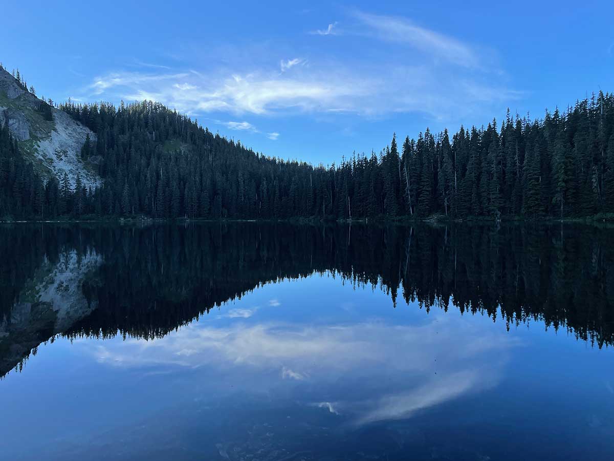
Mirror Lake
We spent our last night on the trail at pretty Mirror Lake, just 8.8-miles via the PCT from our end point, and only 3.4-miles for people who drive up the forest road to a closer trailhead, making it a popular overnight camping spot. Thankfully there are a lot of campsites around the lake and everyone respected quiet time at hiker-midnight (9 pm).
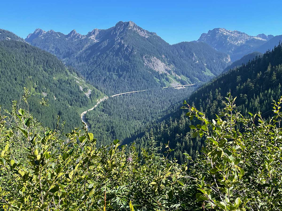
Nearing Civilization at Snoqualmie Pass
As we hiked towards Snowqualmie Pass, the sight and sound of Interstate-90 came into view. I learned that I-90 is the longest Interstate Highway in the United States (3,021 miles), going from Seattle, WA to Boston, MA.
Highlights Video
A short (1-minute, 52-seconds) meditative video montage of wildlife we saw along the trail including a pika and mountain goats, misty views of the Cascades, and my favorite subject: water.