PCT Section through Northern Washington, August 27 - September 18, 2023
From August 27 - September 18, 2023, we hiked our final 259-mile section of the Pacific Crest Trail through Northern Washington State. We were on trail for 21 days, 3 half-days and 18 full-days, averaging 6 miles a day on half-days and 13-miles a day on full-days. We faced many challenges along the way that threatened to end our hike but massive good luck and some wonderful trail angels helped us walk into Canada. Over the 21 days, we ascended a total of 60,006 feet and descended 52,187 feet.
NOTE: The videos below all have music - headphones recommended!
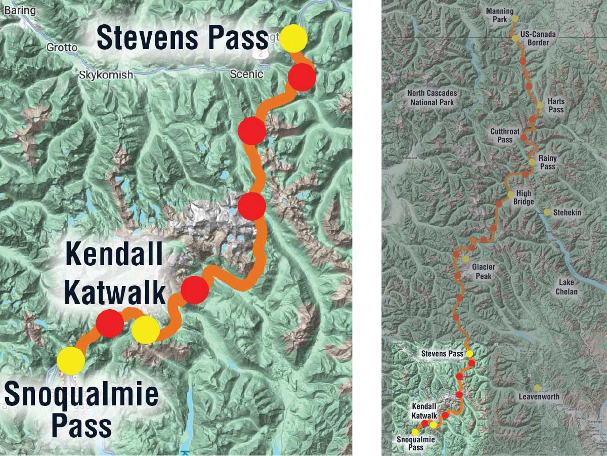
Map of PCT-section hike from Snoqualmie Pass to the Canadian Border, Part 1
Our trip was divided into 3 sections based on where we would pick up resupply packages. Part 1 took us north from Snoqualmie Pass in central Washington to Stevens Pass in 6 days (4 full days and 2 half days) and then east to the iconic town of Leavenworth where we resupplied and took a zero (mile) day.
We almost didn't get on the trail...
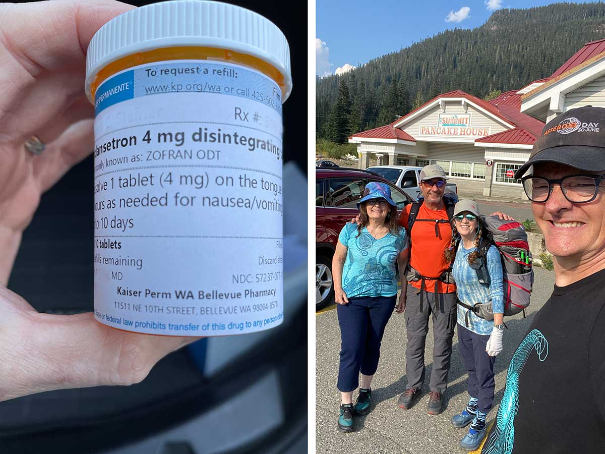
The night before we were supposed to start our trip, Rob developed a bad migraine which soon turned into a night of nausea and vomiting. The next morning we went to the nearby Kaiser Urgent Care where they gave him IV fluids and anti-nausea meds which helped a lot. A small dose of narcotic painkiller made him feel so good that he thought he could actually get on the trail later in the day. He was discharged with a prescription of sublingual anti-nausea meds in case this happens again on the trail and he tried to eat a little food. Our trail angels and friends, Jock and Polle, drove us to Snoqualmie Pass. We got on the trail at 5 pm and walked 4.7 miles and ascended 2,000 feet to a campsite and we both crawled into the tent and fell asleep immediately.
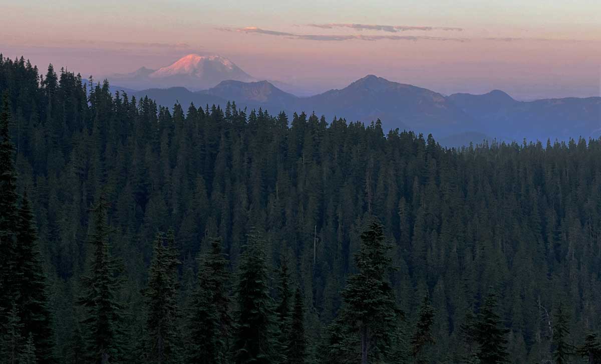
Good morning Mt. Rainier!
The next morning we were greeted by this ethereal smoky view of Mt. Rainier. It was a great way to start the day after what we had been through the previous day.
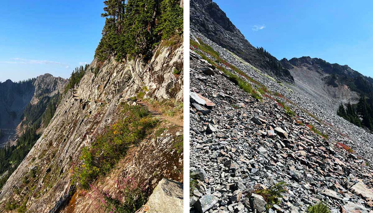
The Kendall Katwalk (left) and lots of scree covered trail (right)
A few miles into our hike we walked across the famous Kendall Katwalk (left), a 150 yard long narrow pathway blasted out of the side of a steep granite mountain face. I wasn't sure how my fear of heights would deal with it but the trail was wide enough that I felt fine. Once beyond the Katwalk, we walked for miles through steep talus fields in the hot sun and had to add 3.5 miles we had lost from the day before - it was a brutal day on top of what we had been through the day before.
Spectacle Lake
We made up the lost miles and reached Spectacle Lake in the late afternoon and enjoyed a swim in the lake before the sun set. You could never tell from this photo that we had thunderstorms throughout the night, thankfully they were all around us and not directly over us.
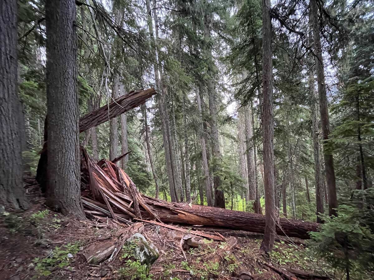
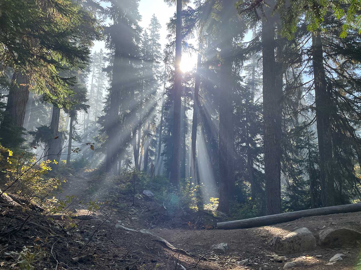
Forest Sculpture
I was struck by the sculptural beauty of this splintered wood from a fallen tree.
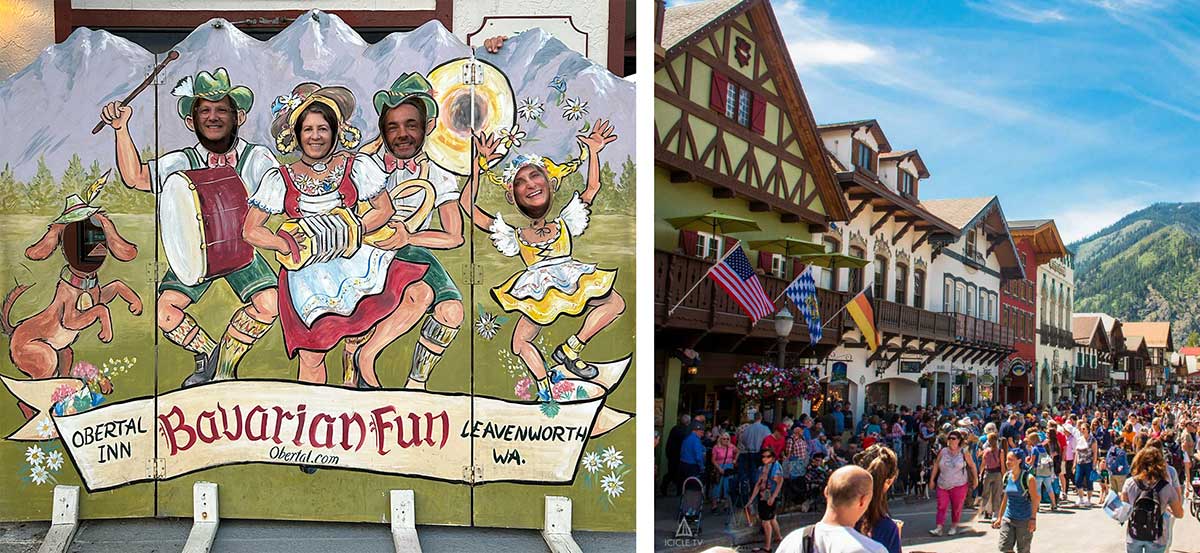
Leavenworth Fun
We reached Stevens Pass in our planned 6 days despite our rough start and met up with trail angels Susie and Mark (my sister and brother-in-law) who brought us our resupply packages. We enjoyed a kitschy weekend in Leavenworth, eating at some good restaurants and washing all our gear.
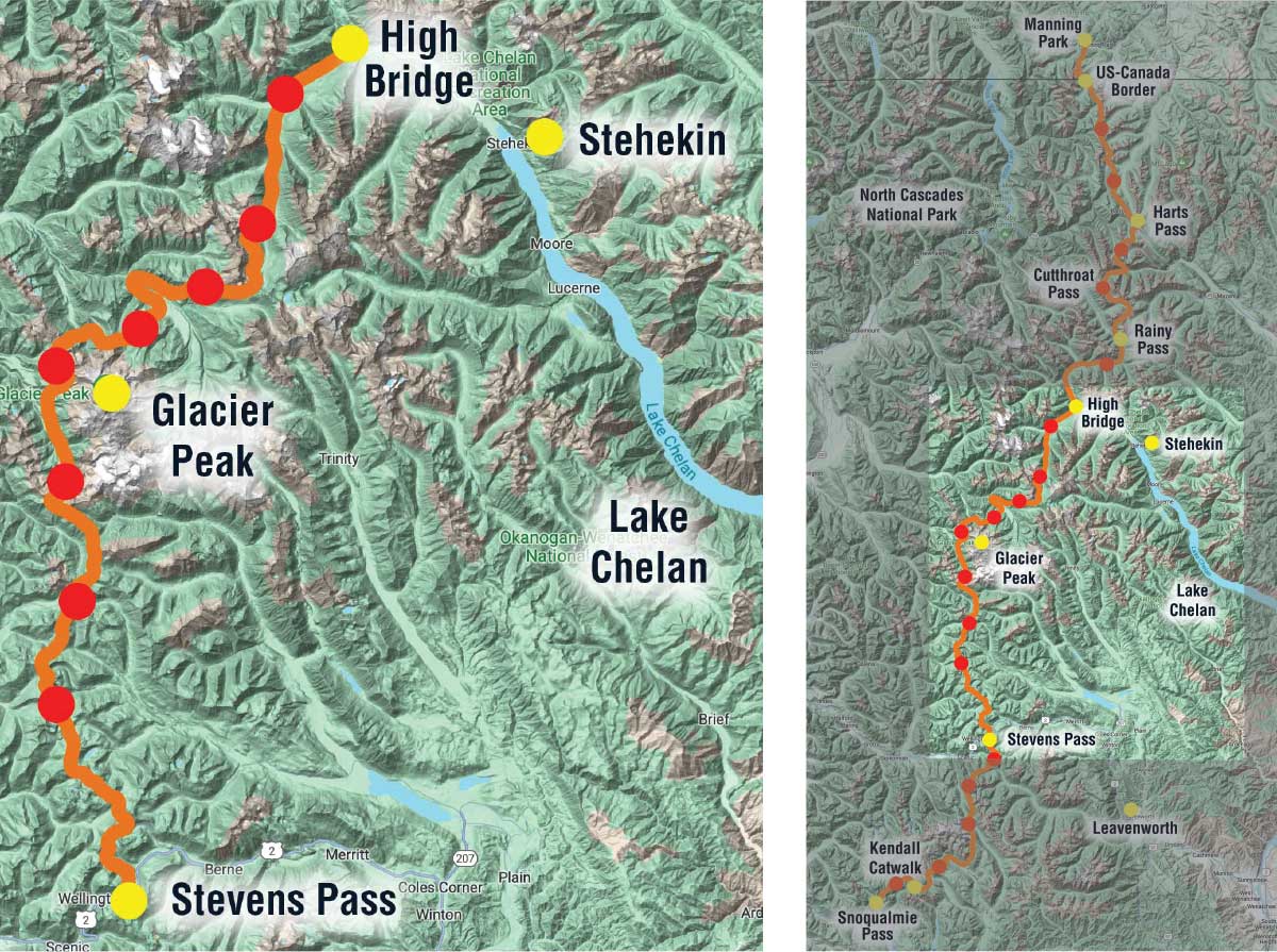
Part 2: Map of PCT-section hike
On the second part of our trip we traveled north from Stevens Pass through the Glacier Peak Wilderness to the charming town of Stehekin in 9 days (8 full days and one half day)
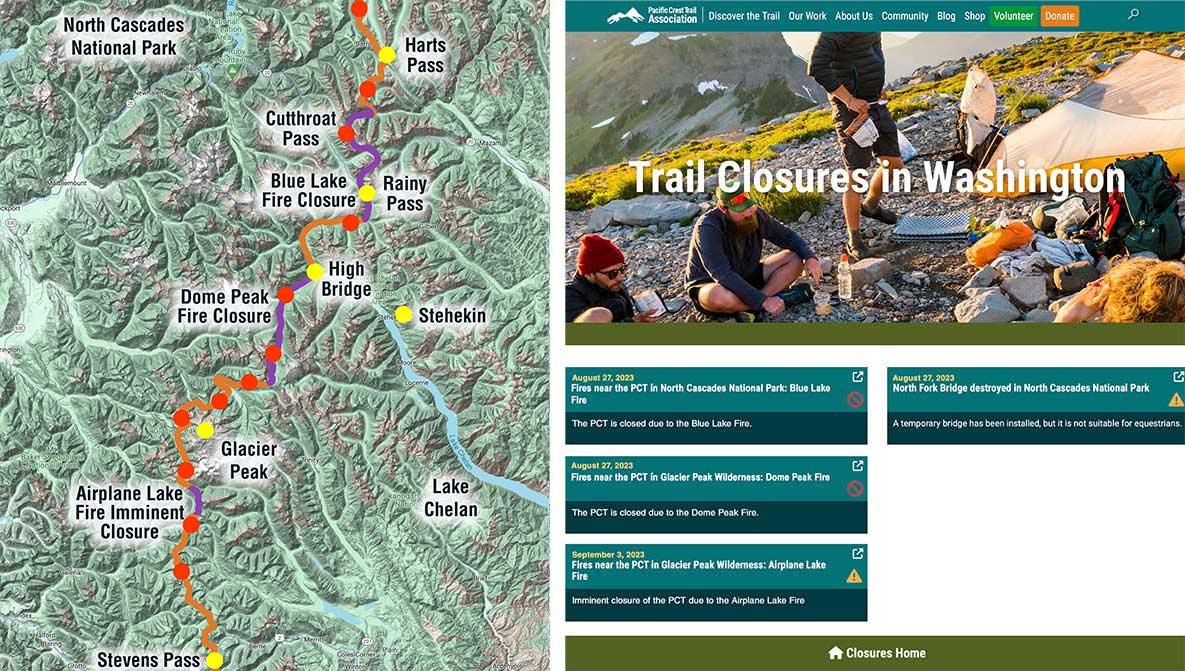
Trail Closures due to Wildfires
We also faced challenges from trail closures due to wildfires burning near the PCT. The day we left for our trip, the Dome Peak fire closed 20.1 miles of the trail in our next section after Stevens Pass/Leavenworth and the Blue Lake fire closed 23.3 miles of trail in our last section from Stehekin to the Canadian Border. And just as we were leaving Leavenworth, the Dome Peak fire area reopened but a new 7.2-mile section of trail was going to close imminently because of the Airplane Lake Fire.
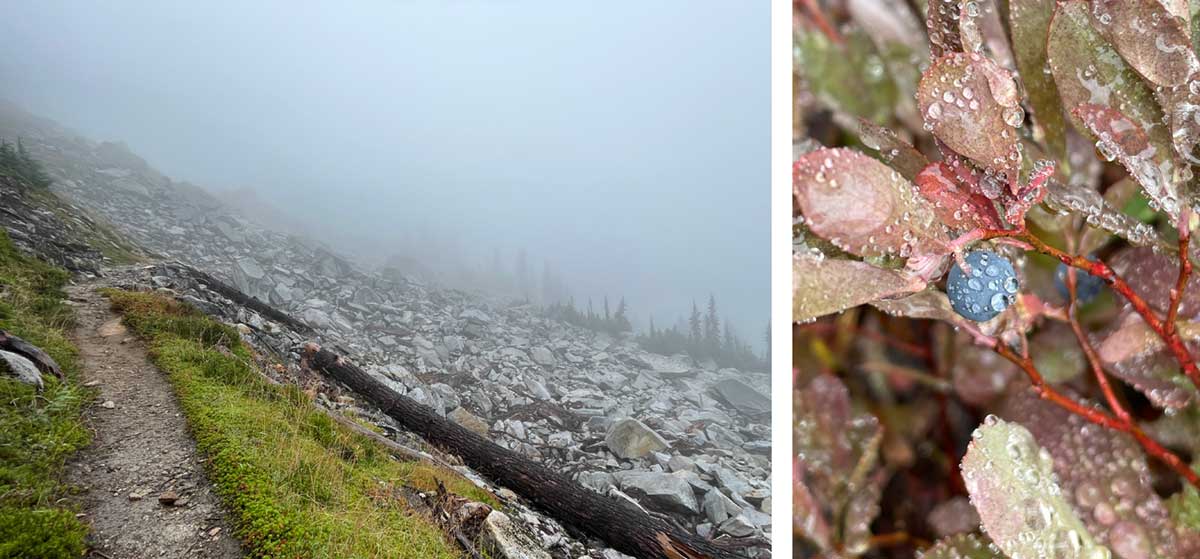
Drizzly weather and Huckleberries
After we left Stevens Pass the weather went from sunshine to clouds and then steady drizzling rain. We were supposed to get amazing views but some days it was like this. The trail was overgrown in a lot of places and the plants were drenched with water. Our pants and shoes acted like sponges soaking it all in. For three days we wrung out our shoes and socks at night, but it was too damp and cold for them to dry, so we put on cold wet muddy shoes and socks each morning. But it wasn't all grim, we were cheered by the occassional sun-break and some late season huckleberries growing along the trail.
River and Creek Crossings
We crossed many rivers and streams, sometimes they were rock hops, others across logs, sometimes on sturdy bridges, sometimes on broken bridges and the oh-so-fun suspension bridges. Sometimes they were wet crossings, some sketchier than others.
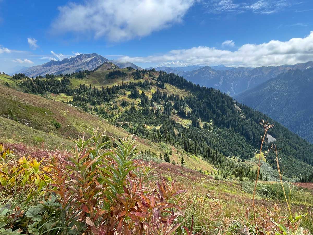
High Meadows
We walked through beautiful high meadows which must be spectacular during wildflower season. We were treated to fall colors.
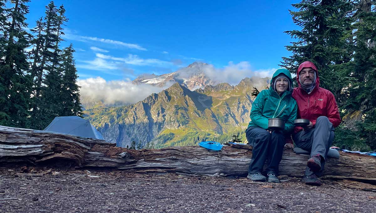
Campsite with view of Glacier Peak
The cloudy weather kept us from seeing Glacier Peak for much of the trip but just as we were finishing our dinner in camp, the peak made a beautiful appearance. Our layers of clothing give a sense of how cold it was during this late season trip.
Two days of hiking over blow-downs
We hiked a 20-mile stretch of trail with many blown-down trees. And most were not just step overs. Our pace slowed significantly since some of the blow downs were so large with no viable walk-around; they presented what felt like rock-climbing (well, I guess, actually tree-climbing) problems to get to the trail on the other side. This short video shows a few of the blow downs we encountered.
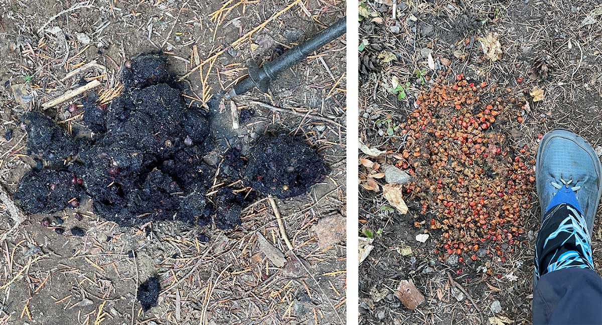
Bear Scat
We saw three bears during our trip but all were too far away for good photographs. We did encounter a rather large fresh bear scat (left) and we were hoping that the size of the scat didn't correlate with the size of the bear in case we encountered the bear. Several days later we encountered this dried older bear scat (right).
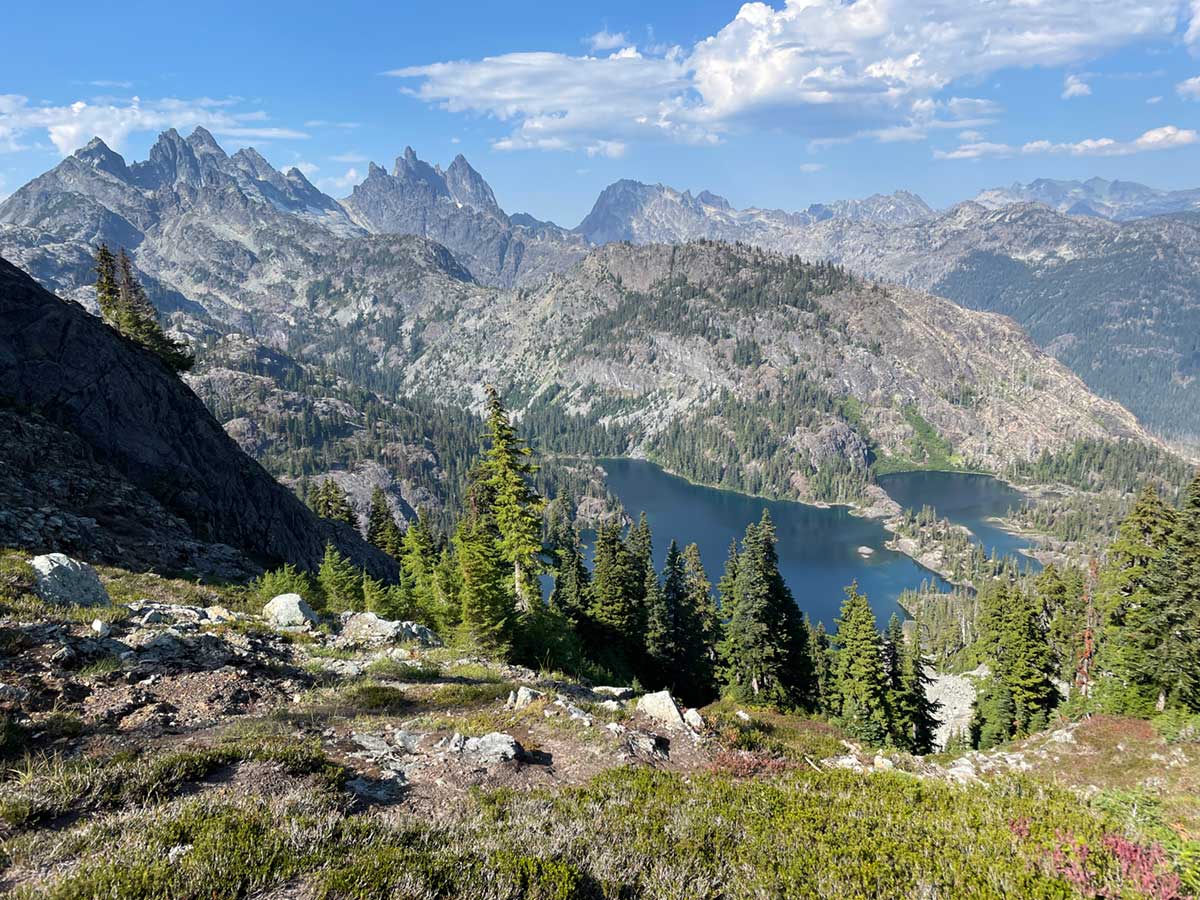
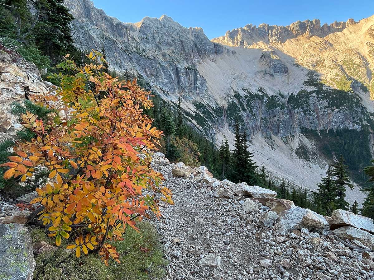
Cascades as far as the eye can see
I loved getting to the tops of passes when it was (relatively) clear out - the views were magnificent. It made the climbs feel so worthwhile.
Amazing Fungi
We were treated to an abundance of fall fungi pushing up through the earth all along the trail. This video is just a small sampling of the diversity of what we saw.
Marmots, Pikas, Frogs, Grouse, Deer and Salmon!
We saw so many marmots and pikas on this trip we lost count. We also saw a lot of grouse, only a few frogs and very few deer. We were very excited to see so many Kokanee salmon swimming in the creek near Stehekin. Enjoy this video which includes footage of a marmot trying to get into my backpack, encountering deer on the trail, and more.
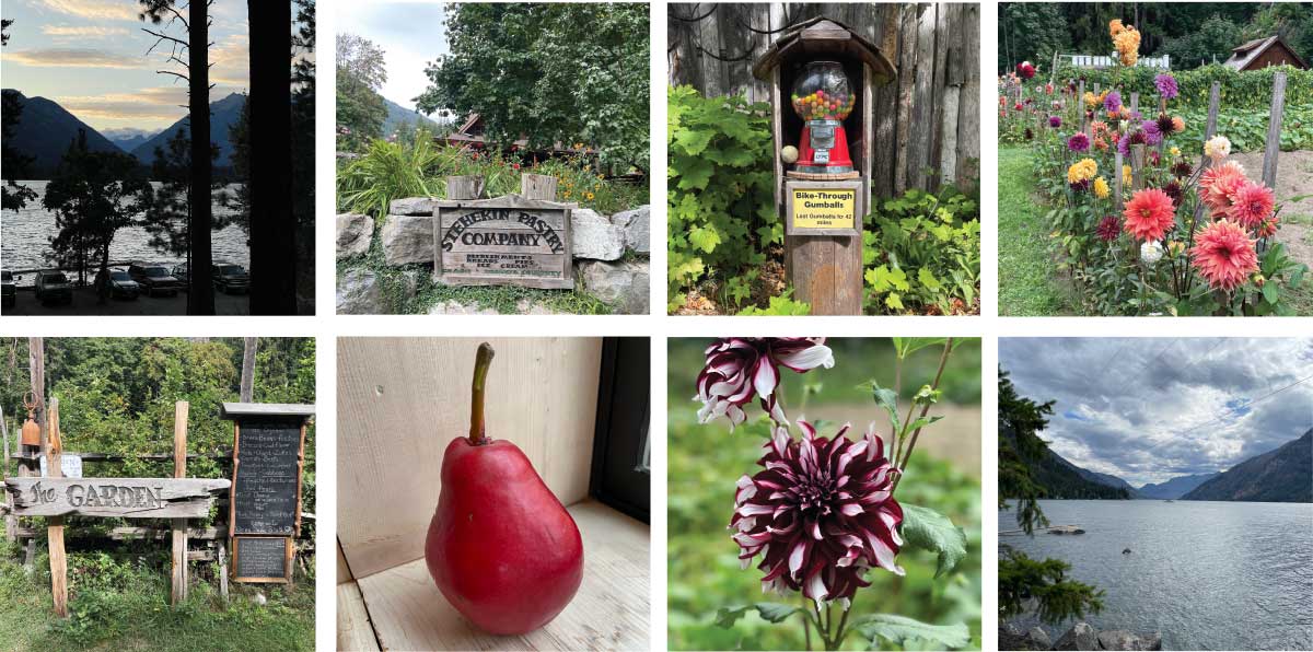
Stehekin!
We luxuriated in the mellow vibe of Stehekin after 9 tough days on the trail. You can only get to Stehekin by ferry or hiking. There's no cell service and limited WiFi. 86 people live in Stehekin year-round; children attend the one-room schoolhouse. There's a fantastic bakery where the cinnamon rolls are legendary and a beautiful organic garden where the owner grows 50 different kinds of dahlias in addition to vegetables and delicious red pears. Most people get around by bicycle and walking. There's a bus to the trailhead, 11-miles down the road, 4 times a day. Ferries transport people the 50-miles between Stehekin and the nearest town to a highway, Chelan. We thoroughly enjoyed our time there and look forward to returning.
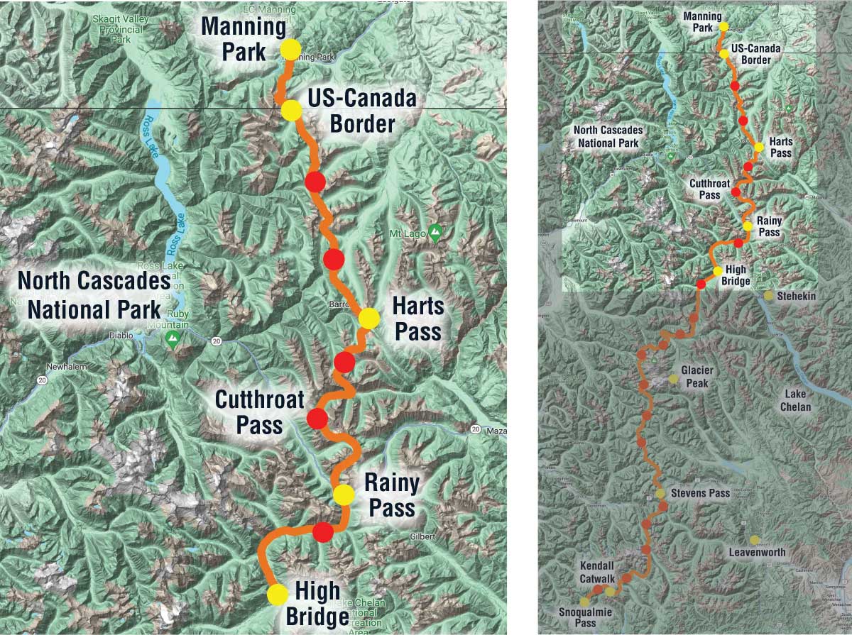
Part 3: Map of PCT-section hike
On the third and last part of our trip we traveled from Stehekin, through a North Cascades National Park to the US-Canada border and then on to Manning Provincial Park in British Columbia in 7 days.
Smoky morning
We only had one seriously smoky day on our trip that got me to put on the emergency N95 mask I carry exactly for this reason. Considering how many wildfires were burning around us, we were incredibly lucky to only have one bad day.
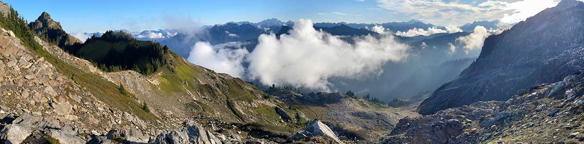
View North of Cutthroat Pass
We camped on top of beautiful Cutthroat Pass, just past Rainy Pass. Hiking north of the pass was beautiful and rugged.
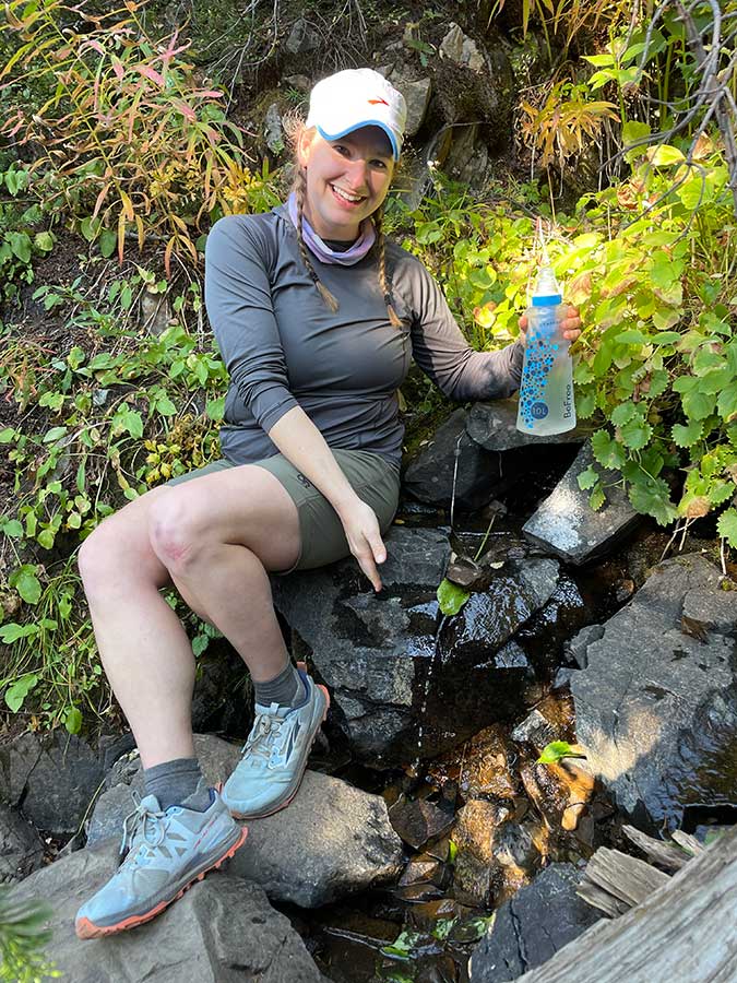
Leaf Engineering
Our friend Carolyn demonstrates her "leaf engineering" skills, essential for obtaining water from streams whose flow has diminished to a trickle - by carefully placing a fresh leaf and holding it with a rock, you can create a spigot to fill your filter bag. Carolyn was part of our trail family last year on the PCT and she met up with us at Harts Pass and joined us for a fun reunion overnight on the trail.
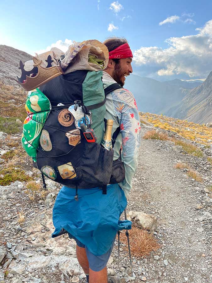
Triple Crown hiker "Eager Beaver"
As we got within 15 miles of the border, the atmosphere on the trail was celebratory. Everyone was giving fist bumps and high fives as we passed each other, congratulating everyone on reaching the end, even before we got there! Most people we met didn't have the special border crossing permit to enter Canada so they were tagging the Terminus monument and retracing their footsteps 30 miles to Harts Pass, the closest trailhead in the US.
The day before we made it to the border, we met "Eager Beaver." He was excited beyond words to be completing the Triple Crown (The Pacific Crest Trail + The Continental Divide Trail + The Applachian Trail). He had tried to through-hike the PCT last year and had to abort his trip just before reaching the border because of a wildfire. This year he through-hiked the Continental Divide Trail and he was back to finish the last 30-miles of the PCT with a bottle of champagne.
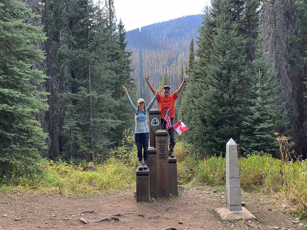
We made it to the border!
259-miles and 21 days of hiking later, we made it to the PCT Northern Terminus Monument at the US-Canada Border. I wasn't sure how I would feel when I got there since I had not hiked the entire trail. It was somewhat anticlimactic: we were hiking down a forested hillside and turned a corner and just like that, there was the monument in a small flat clearing. And then I was hit with a wave of emotion, feeling immense gratitude for being able to do this, for all the fascinating people I had met along the way, and for all the trail angels who have helped us over the years. And I felt somewhat whistful about reaching the end of a decade-long project.
As an aside: there is a pronounced clear-cut line behind us and I couldn't figure out what it was for: usually I see these for power lines but there were none. Was it for marking the border? But why would anyone want to do that? I researched it and learned about "The Slash" a 20-foot wide clear-cut through forests along the US-Canada Border, all the way from the Pacific to the Atlantic Ocean. No walls to secure the border here, just impenetrable forest. Read about the fascinating history in this article on Atlas Obscura. And for those of you who love the idea of doing unique hikes, this article is a hilarious description of how to hike The Slash from Lake of the Woods in Minnesota to Vancouver.
PCT Northern Terminus Log Book
Flipping through the log book stored safely in a waterproof box behind the PCT Northern Terminus monument we found entries from the hikers we had met earlier in the trip, happy to know they had made it to the end, despite the fire closures. Some people write long emotional descriptions of their experiece, others write a quote or something silly and fun. I wrote words of gratitude.
We spent about 20 minutes at the monument, resting and looking at the journal. We were the last hikers of the day and we had missed the trail magic that was there earlier in the day. It was still early in the day to stop hiking: our original plan was to camp in the campsite just across the river from the monument. It was another 8.2miles to Manning Park and we decided to go for it, turning our 11.2 mile day into a 19.4 mile day. We made it there just after dusk, booked a hotel room, and got to the restaurant 15-minutes before it closed.
Meditative Moments along the PCT
Thank you for following along with our trip all the way until the end! In closing, please enjoy this meditative video of clouds and mist, glacial melt water streams, patterns in water, sunset and sunrise on Cutthroat Pass. May it bring some calm and beauty into your day.