Lake Tahoe Wilderness Areas, July 7-10, 2025
A camper-van trip to the wilderness areas around Lake Tahoe with hikes in Auburn State Park, Tahoe National Forest, Desolation Wilderness, and the Dardenelles Roadless Area.
Auburn State Park
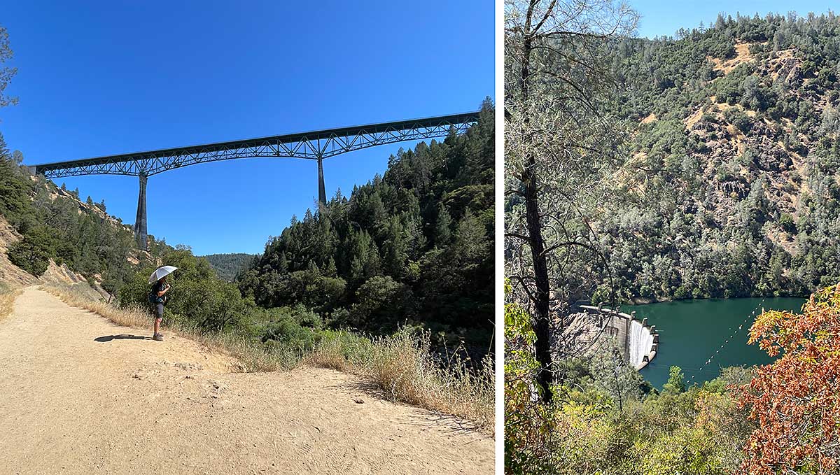
On our way to Tahoe, we stopped at Auburn State Park to hike the Confluence and Clementine trails loop. We got to see the highest bridge in California and the Lake Clementine Dam on the North Fork of the American River. We regretted hiking in the afternoon – it was 96 degrees when we started and even with a silver reflective trekking umbrella and lots of water, my body experienced heat stress.
ICE road sign
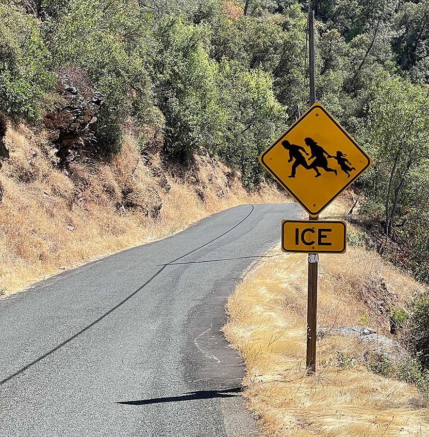
In order to connect from the Confluence trail to the Clementine trail, we had to walk along a paved road for a while. Usually, wilderness hiking is restorative and a true getaway from every day life but it was hard to take our minds off recent events.
Trail to Loch Leven Lakes
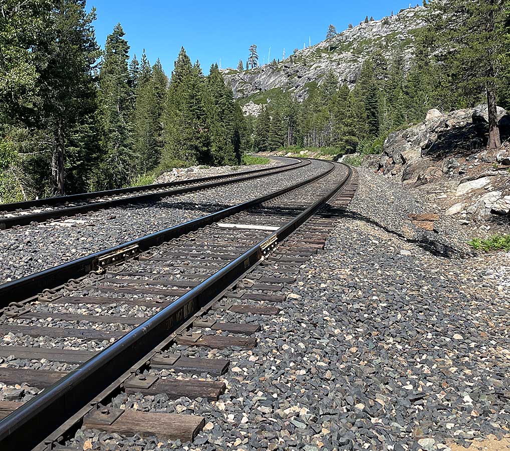
We hiked up to the three Loch Leven Lakes in the Tahoe National Forest. The trailhead started at the Big Bend exit off I-80 west of Soda Springs. The trail crosses the Union Pacific railway used by AmTrak and freight trains. These tracks were constructed on the original 1860s route of the Central Pacific railroad, hand built by Chinese laborers. Why Chinese workers? Because they could be hired at a lower cost than white American workers to do this difficult work.
Upper Loch Leven Lake
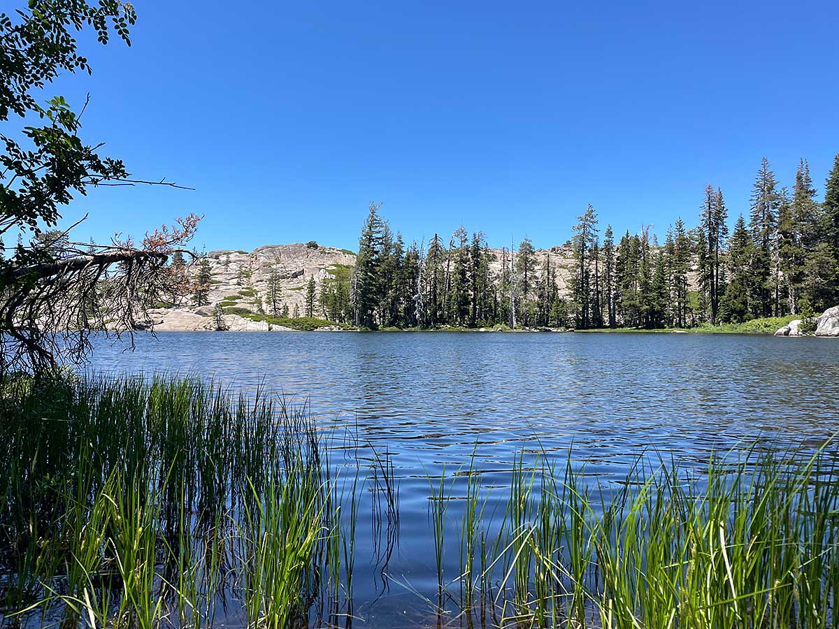
Hiking through a granite landscape again made us feel like we were home again. The three Loch Leven lakes were very different from one another and Upper Loch Leven Lake was our favorite. The trail was very eroded and rocky, creating the perfect level of challenging training conditions.
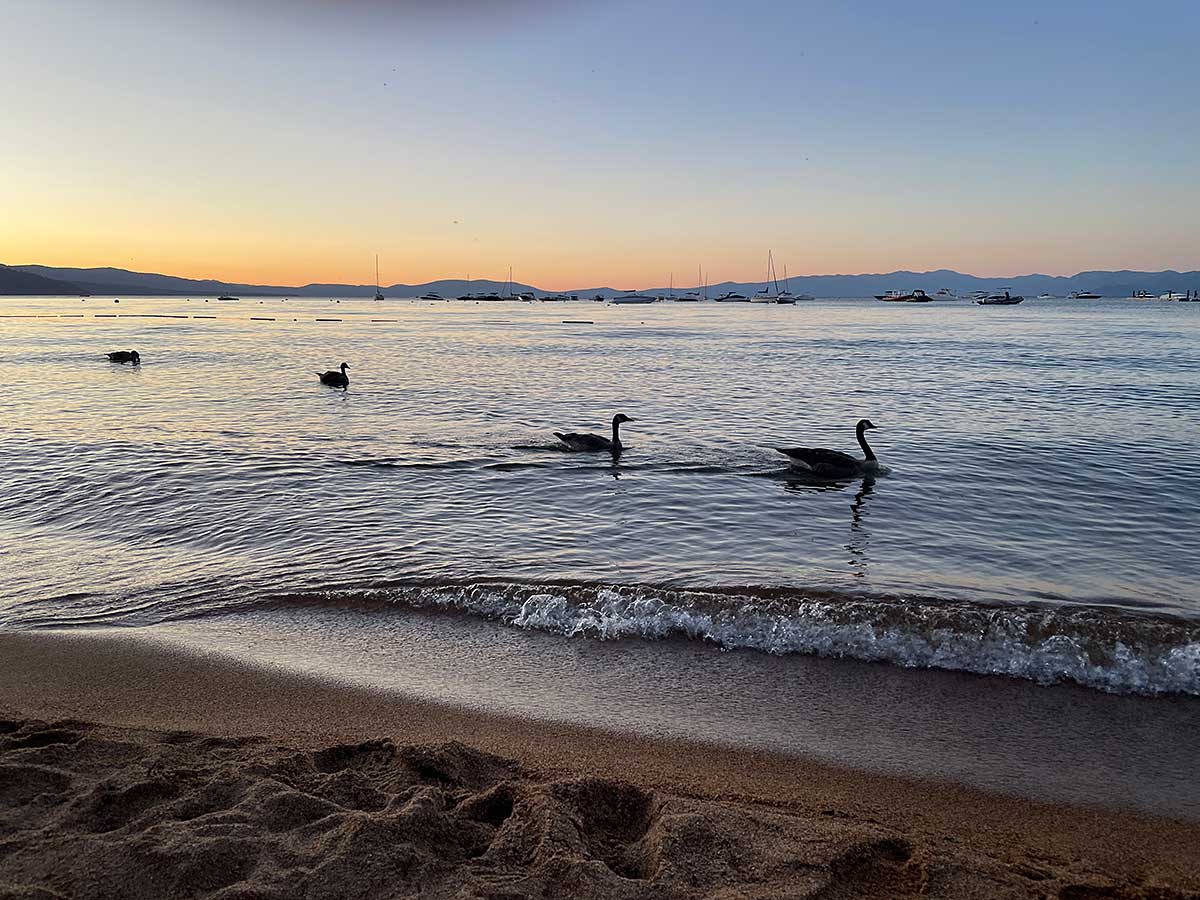
Sunset on Lake Tahoe
We managed to get a last-minute campsite at Camp Richardson so we could be near the Mt. Tallac trailhead to hike the next day. The campground is on the shore of Lake Tahoe and we enjoyed sunset on the beach as some geese swam by.
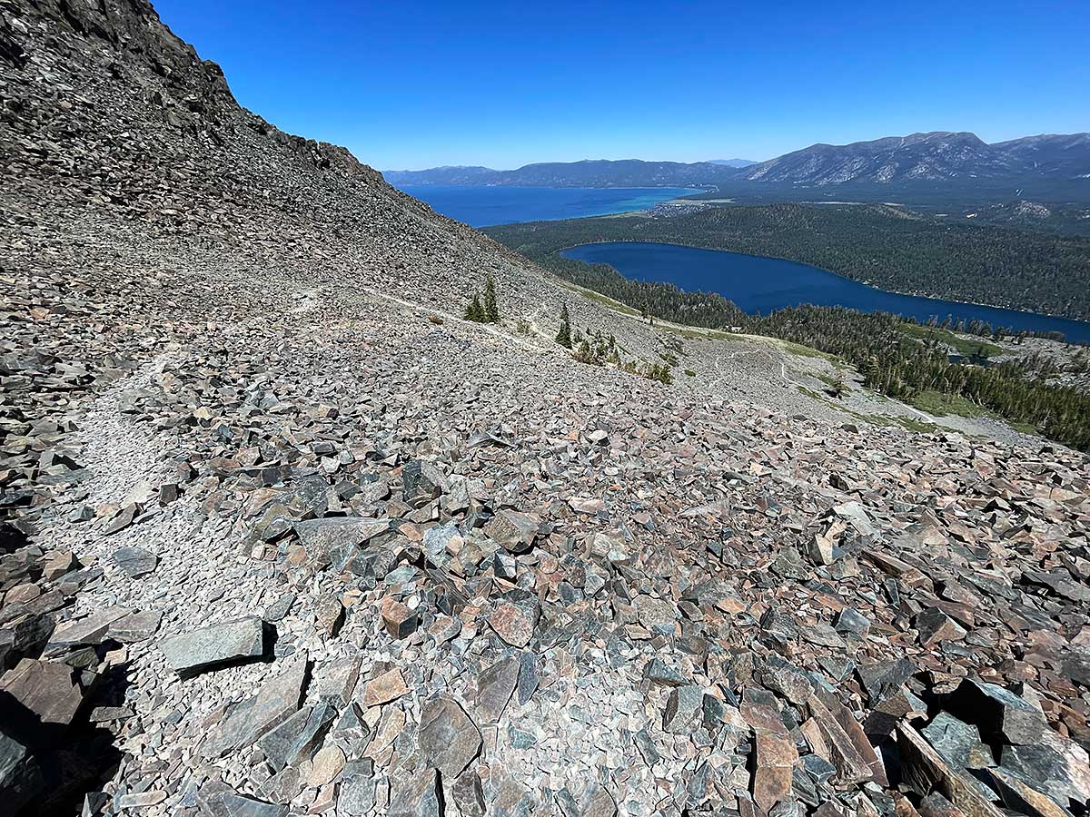
Mt. Tallac Trail
It’s only 5 miles to the summit of Mt. Tallac but you gain 3,284 feet and hike up through this long section of scree to get there.
Panorama Video from the summit
The reward for reaching the 9,738 foot summit of Mt. Tallac is an incredible 360-degree view of Lake Tahoe, Fallen Leaf Lake, the Desolation Wilderness and beyond. It was fun to identify places we hiked through in Desolation, both on the PCT and other trips. Note: it wasn’t easy to film this video because I was standing on some small rocks on the scree covered the summit so please forgive the camera jitter in spots.
Mama Bear and her cubs
We camped for free in the Forest Service Campground near Luther Pass, south of South Lake Tahoe. Just as we pulled up, we observed a mama bear and her two cubs patrolling the campground hoping to take advantage of inexperienced campers who might leave food out unattended. Sadly mama bear succeeded and grabbed a steak off the grill of a couple camped near us. We had no idea where the couple was but as soon as we saw this happening we jumped out of the van and started making noise to try to discourage the bears but it was too late. I filmed this video when the bears returned an hour later to try their luck again – the ignorant campers had packed up their entire campsite and left and this time the bears were unsuccessful.
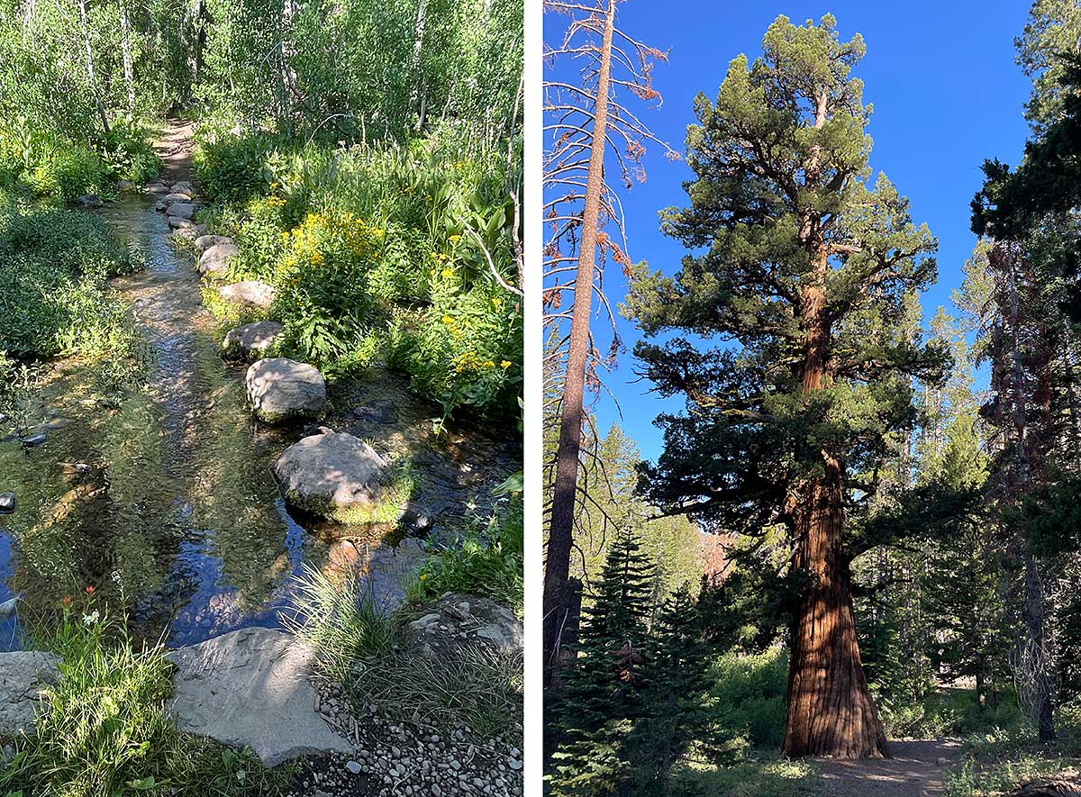
On the trail to Dardenelles Lake
We hiked a short section of the Tahoe Rim Trail in the Dardenelles Roadless Area and then took a spur trail to Dardenelles Lake. We had several stream crossings along the way and this one (left) felt like a zen garden. We also walked past an old growth tree (right) which a friend identified as a Juniperus grandis; the entire Tahoe area was so heavily logged during the 1800s, it’s highly unusual to see old growth trees like this.
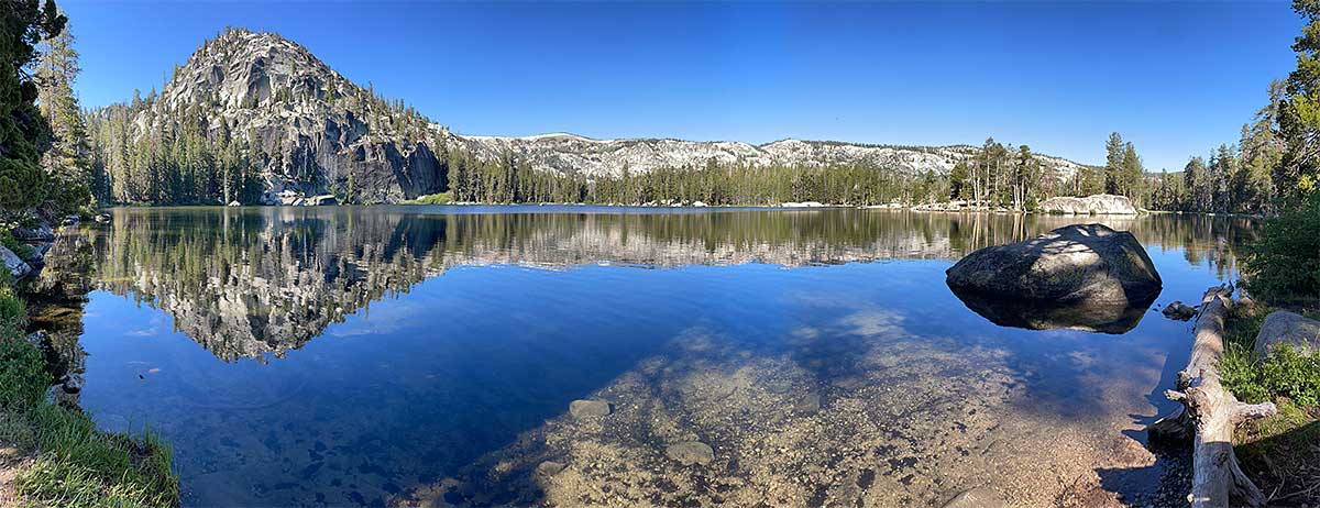
Dardenelles Lake
This lake is definitely worth a visit. Most people don’t take the spur trail to see this pretty alpine lake but we were glad we did.
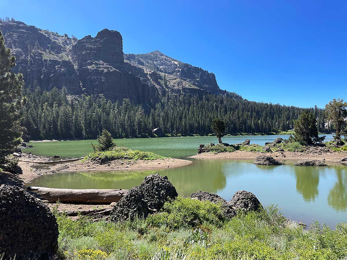
Round Lake
We returned to the trail junction with the Tahoe Rim Trail and continued on to Round Lake, a very popular destination for backpackers and day hikers. In contrast to Dardenelles Lake, the water was an intense green color, and the surrounding rock was more volcanic.
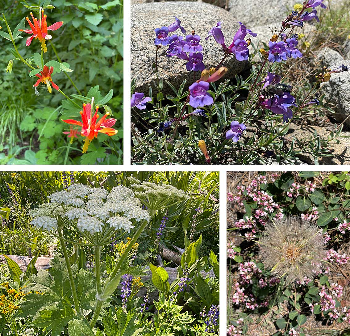
Wildflowers
Although most of the snow was long gone, we saw a lot of wildflowers as we hiked so I thought I’d share a few. Thanks for following along until the end!