PCT from Kennedy Meadows to Horseshoe Meadow, August 5-9, 2025
5-day, 66-mile Backpacking trip along the Pacific Crest Trail from Kennedy Meadows South, known as the gateway to the Sierra, to Horseshoe Meadow. Over the course of 4 days, we ascended through a changing landscape: from desert scrub to meadows to forest and finally, granite. Our trip culminated with summiting Mt. Langley, the southernmost 14-thousand foot peak in the Sierra. We also had a surprise encounter on our summit day - check it out below!
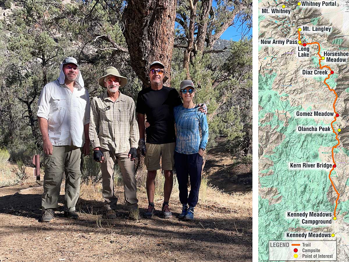
Happy backpackers at start of trip and map of our route
All fresh and energized, we're ready to start our hike. The map on the right shows the route of our 5-day trip, where we camped and things we saw. Water was scarce along this section and that determined where we camped each night.
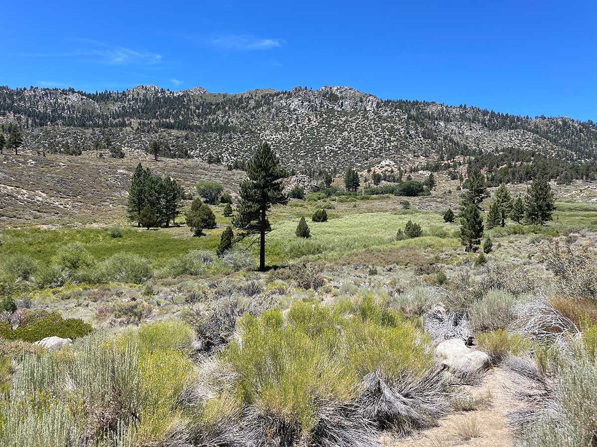
Desert scrub transitioning to meadows and forest
We began our trip at 6,000 feet in the desert mountains. As we hiked higher in elevation each day, the landscape changed from desert scrub to meadows and forest.
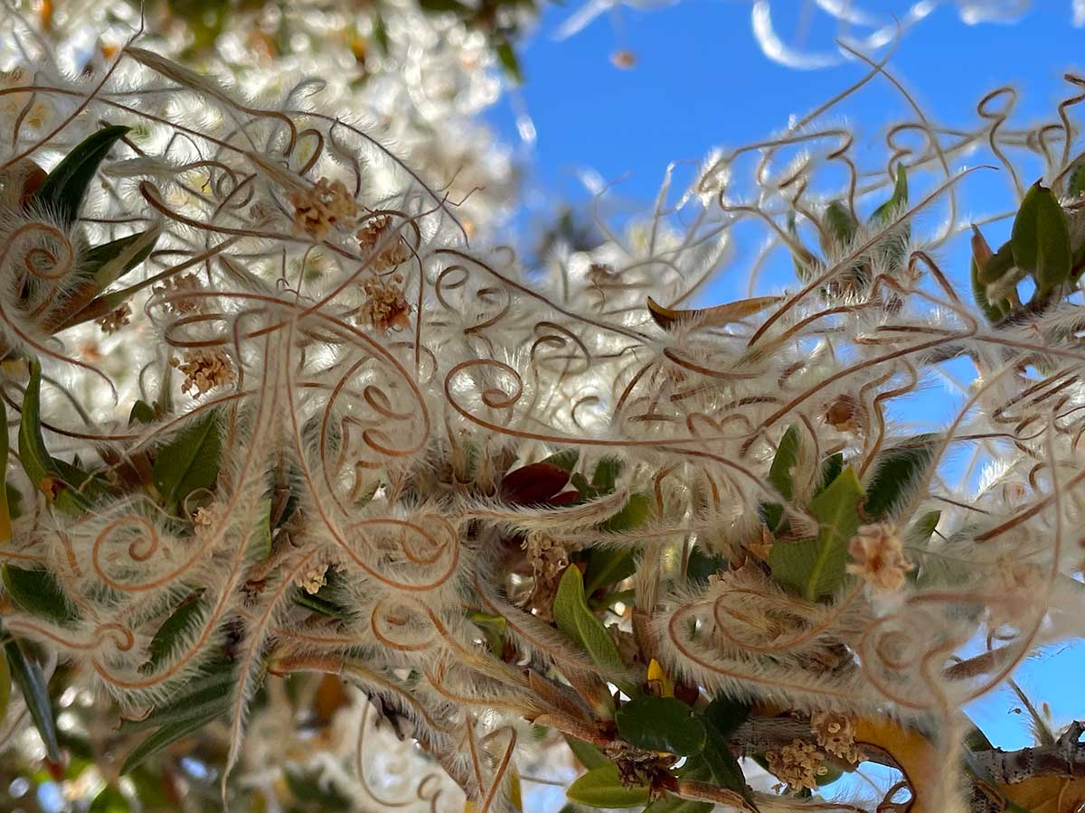
Caligraphic seed tendrils
On one of our rest breaks, I found myself drawn to the graceful spirals of these seed tendrils. I have never seen this before and have not been able to identify what kind of bush/tree this is.
Kern River Bridge Campsite
We had crossed the South Fork of the Kern River and walked parallel to it for a short while early on our first day and then didn't encounter water again until 12.3 miles later where we met up with the river again, further upstream. This is where we camped for the night since the next water source was another 12.7 miles away.
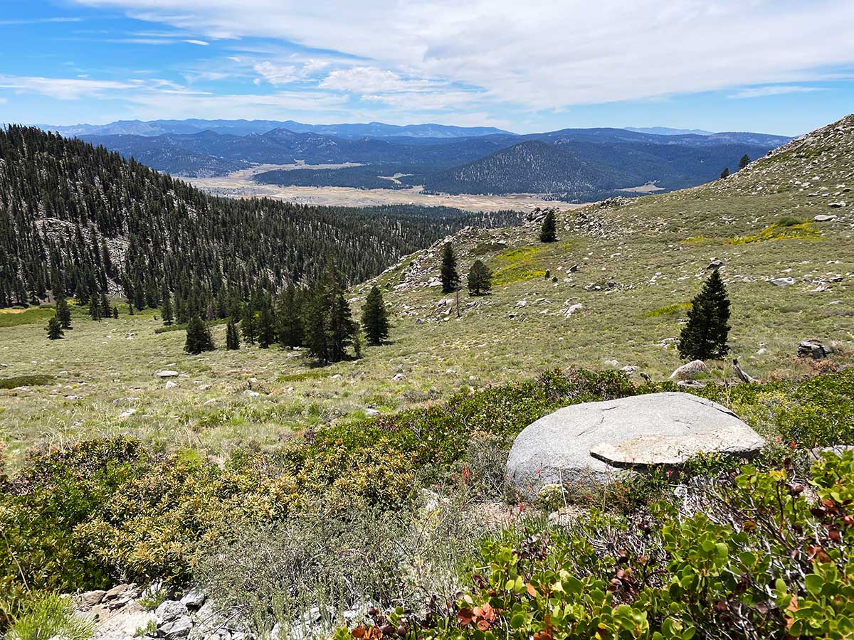
Meadows Becoming Forests and High Peaks Appear
We walked for miles through alternating meadows and forests and saw cows grazing in the meadows on forest service land. Our excitement built as the peaks of the High Sierra appeared in the distance.
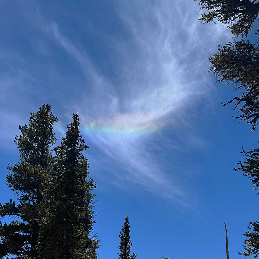
Cloud Irridescence
Cloud irridescence (i.e., this rainbow in the cloud) is a rare phenomenon caused by the diffraction of sunlight through small water droplets or ice crystals in thin or semi-transparent clouds.
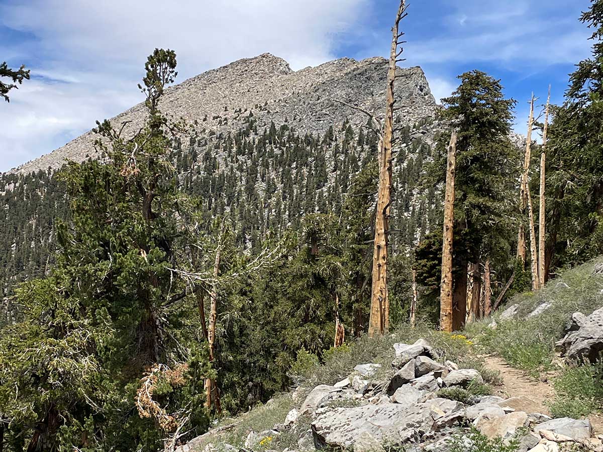
Olancha Peak
One of the highlights of our second day was walking along the western side of Olancha Peak with its distinctive jagged edge. It was fascinating to watch how the shape of the peak changed from each different vantage point.
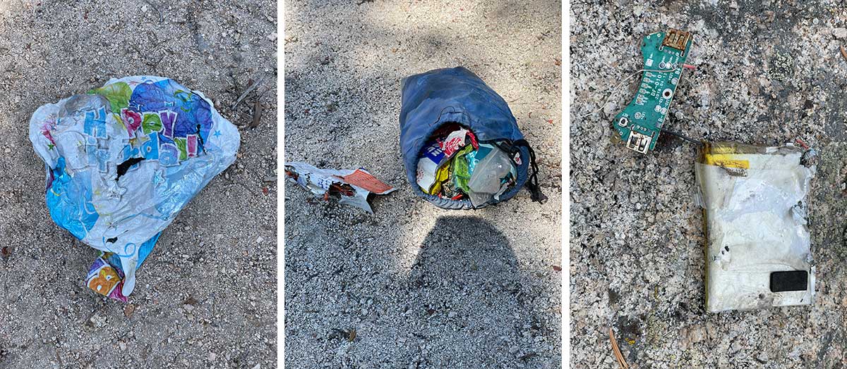
Garbage found off trail
We frequently find garbage on our trips and Rob usually packs it out. Most of the time we find things dropped on the trail or left in campsites but we found all 3 of these items quite a bit off trail. The only item we didn't pack out was what looked like what remained of a charging device; the battery looked too dicey to pack out safely so we took a GPS reading and left it in an obvious place and informed the forest service office about it when we got back.
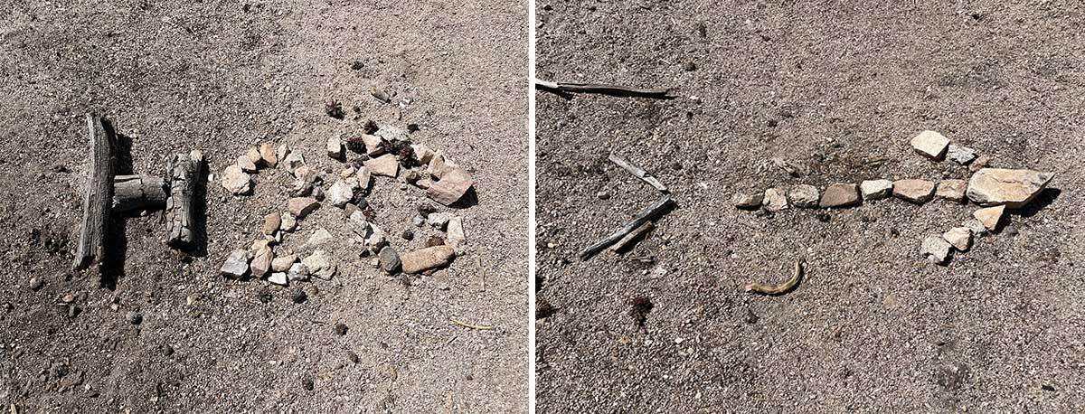
This way for water
The Pacific Crest Trail can have long waterless stretches, especially in desert areas or when walking along the crest in summer or fall when seasonal streams have dried up. Occasionally there are springs located a half-mile or so off the trail. Hikers will somtimes create low-impact signs next to the trail using sticks and rocks to alert other hikers to a side trail that leads to an off-trail spring.
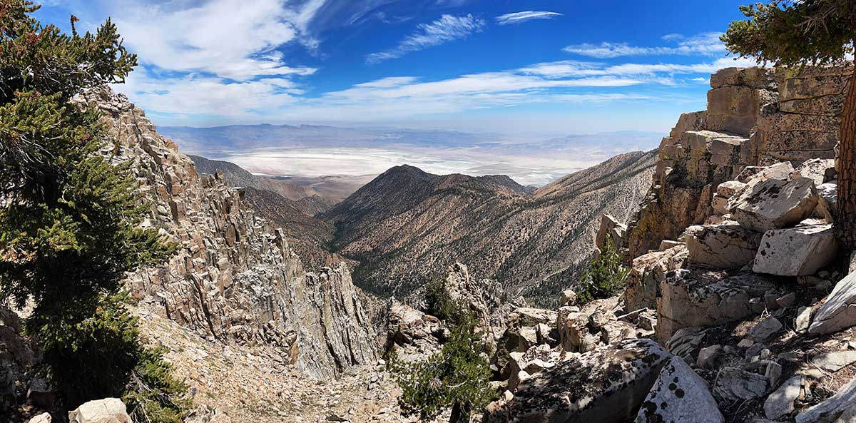
View of Owens Lake
The Pacific Crest Trail weaves its way along of the crest of the Sierra, sometimes crossing from one side to the other. This gave us occasional views of the Owens River Valley to the east, including this specatacular view of the dessicated Owens Lake bed. We stopped here for a rest and in a moment of bizarre coincidence, a fighter jet suddenly appeared, flying up this canyon and flew directly over us while doing a full 360° flip. We were terrorized and exhilirated by how close it came to us and how ear piercing loud it was (sorry, it all happened too fast to get a photo).
Note: this was not the surprise I alluded to at the beginning of the photo essay, that's at the end.
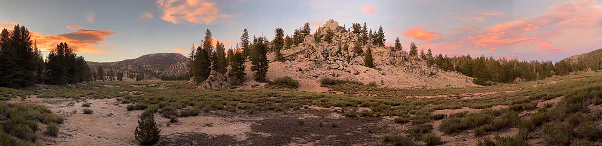
Sunset at Diaz Creek
We camped at Diaz Creek on our third night . During dinner some cows approached our camp, definitely getting our attention, but they soon lost interest and walked away. After dinner we took a short walk down to the creek and were treated to this beautiful sunset sky.
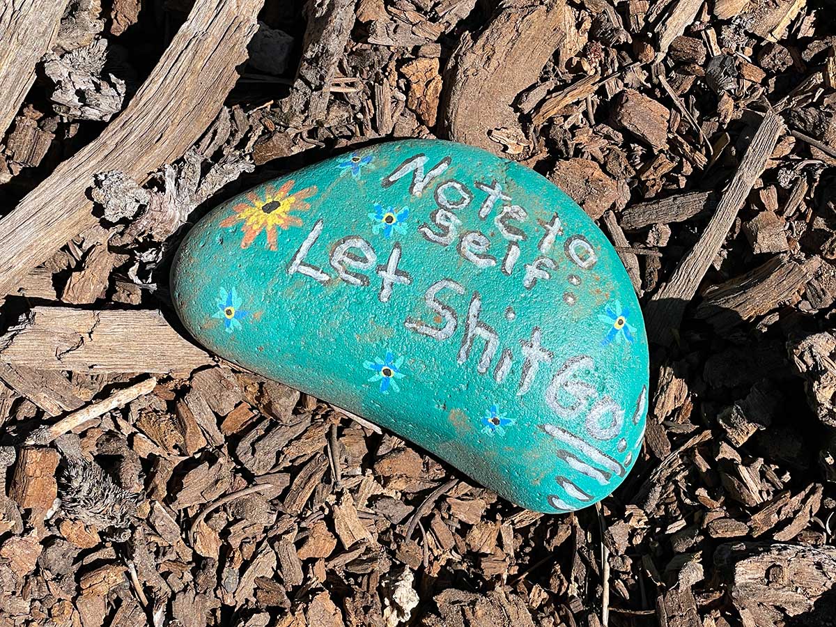
Inspirational Rock
We noticed this painted rock along the side of the trail on our way down to Horseshoe Meadow on the morning of our fourth day. A good reminder for all of us.
View of Mt. Langley
After reaching Horseshoe Meadow, we resupplied our food and headed back up the trail to Long Lake. We walked past two of the Cottonwood Lakes, along with this view of the summit of Mt. Langley, the next morning's destination. Funny, it doesn't look that far away!
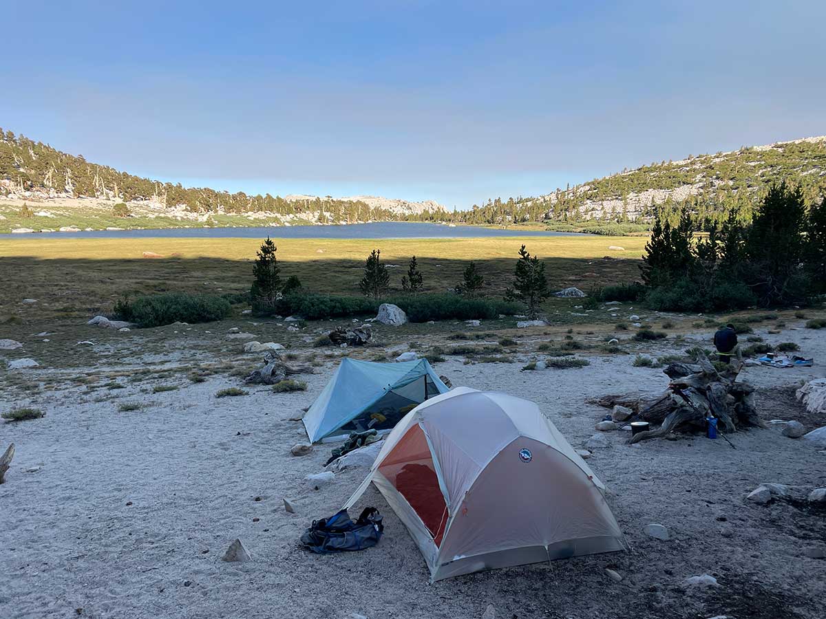
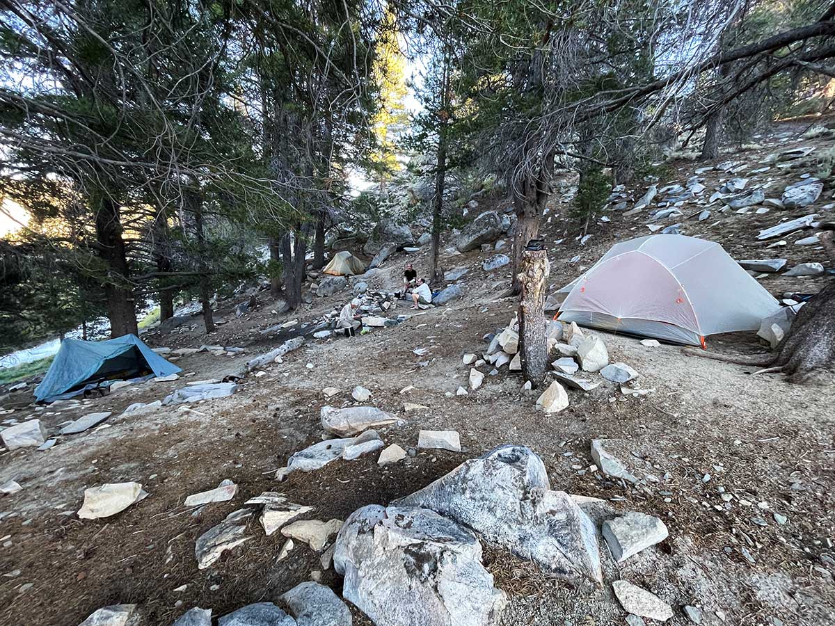
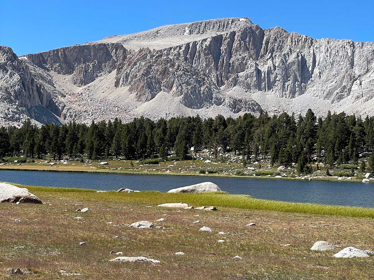
Camp at Long Lake
Long Lake is a popular destination with weekend backpackers and hikers who are sumitting Mt. Langley. We felt lucky to find this beautiful campsite with a view of the lake so late in the day.
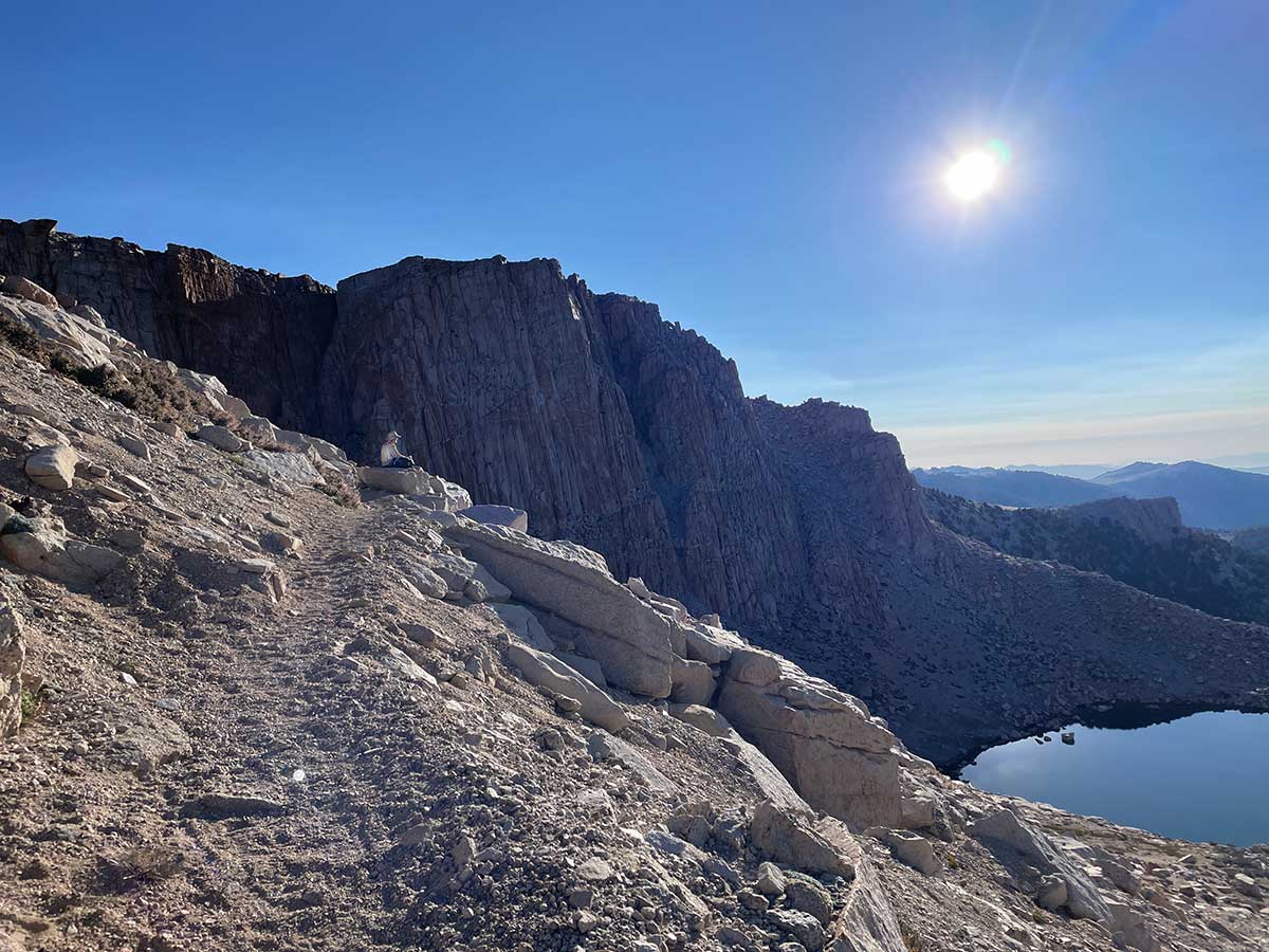
New Army Pass
It's a 3,500 foot climb from Long Lake to the summit of Mt. Langley and hiking up New Army Pass accomplishes the first 1,000 feet with some beautiful views. Our friend Dwight is taking a break, and enjoying the view.
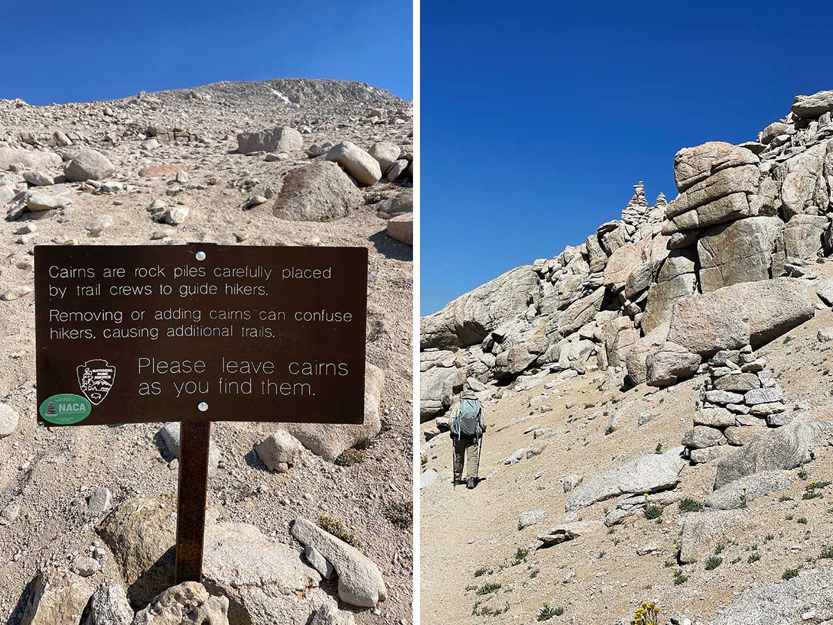
Cairns mark the way
The trail becomes less distinct as you reach the scree and gravel closer to the summit. The park service has built some rather large cairns to help mark the way on this popular trail to keep hikers on the same route. The three cairns in the photo on the right mark a tricky 3rd class rock scramble up through the rocks.
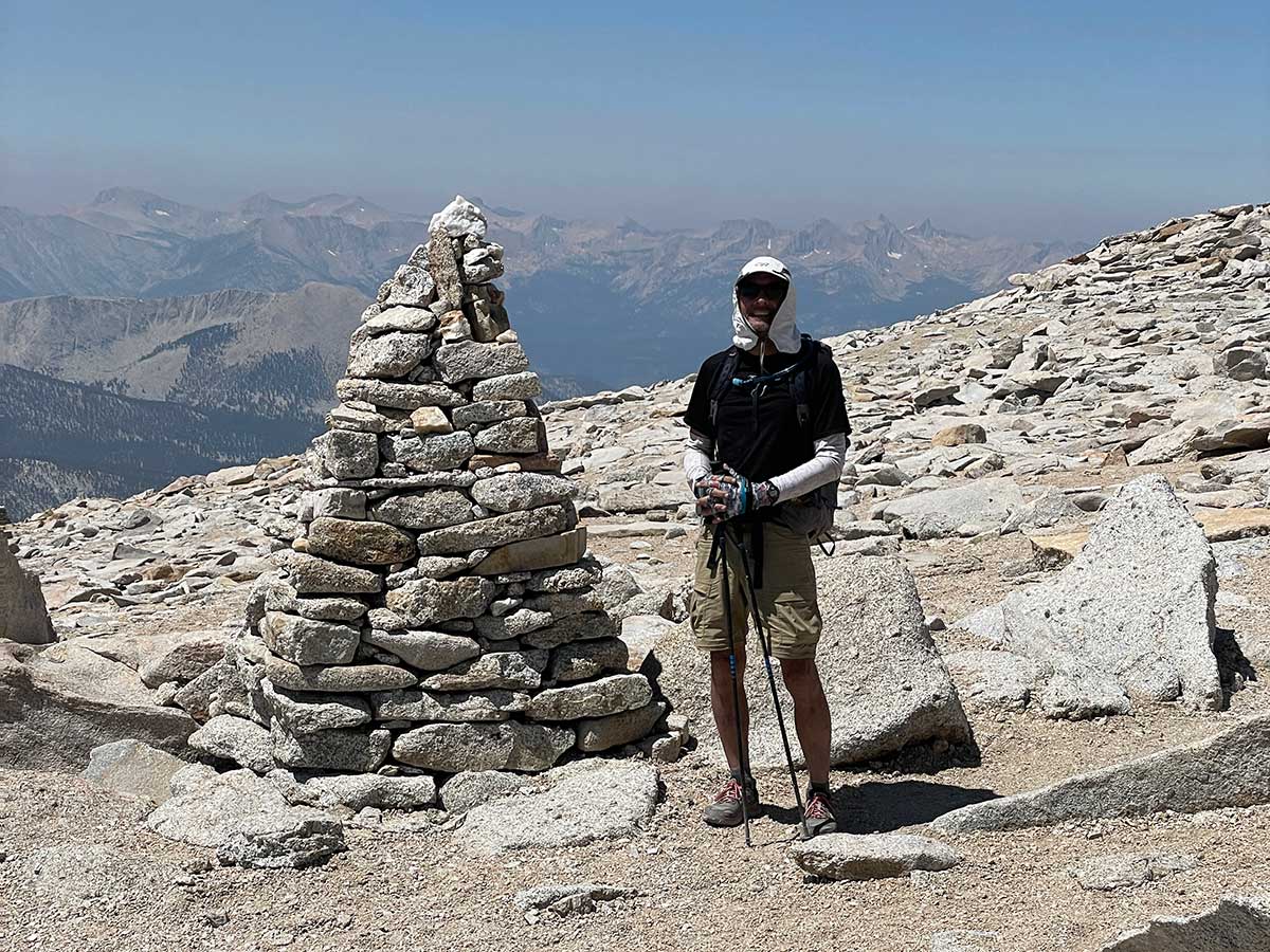
Really big cairns
These cairns aren't the usual small rockpiles. They are seriously large and well engineered. Here's one with Rob for scale.
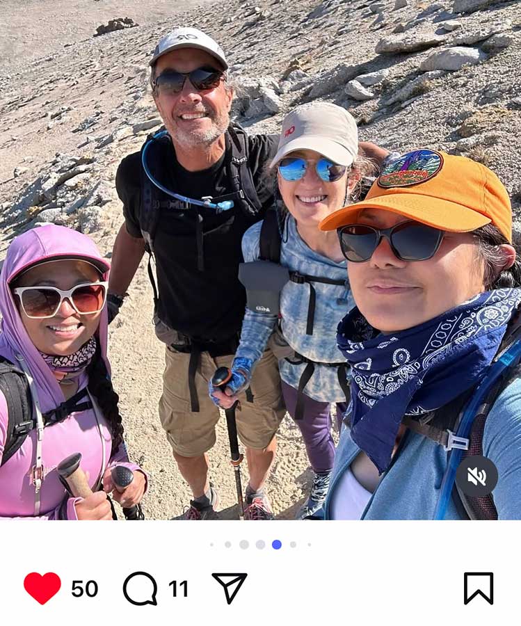
A surprise encounter at 13,000 feet
We attempted this trip last year and only made it as far as Long Lake because Rob got very sick in the middle of the night. He was up all night vomiting every 15 minutes, which kept me awake as well. We were camped quite close to a group of four women who were planning to summit Mt. Langley the next day. At 5 am I packed up our gear to hike back to the trailhead and I heard the women next to us getting ready to leave for their summit climb. I approached them to apologize if Rob's sickness disturbed their sleep and they were completely unaware of it and immediately felt concerned and wanted to help. They gave us some of their electrolyte tablets and were so kind. Fast forward a year later to our Mt. Langley summit day: we were about half way to the summit and saw two women walking towards us. We stopped to talk to them, remarking that they must have gotten a very early start if they were already on their way back. They told us they intentionally didn't summit, having summitted last summer and were just using this as a training hike for a Mt. Whitney climb in a couple of weeks. There was something familiar about them and I asked, if by chance, they were part of the group of four women from last year camped near us when Rob got sick. They both let out enthusiastic screams of "yes! that was us!" and there were big hugs all around. What are the chances of that happening? This chance encounter brought so much joy to all of us throughout the entire day.
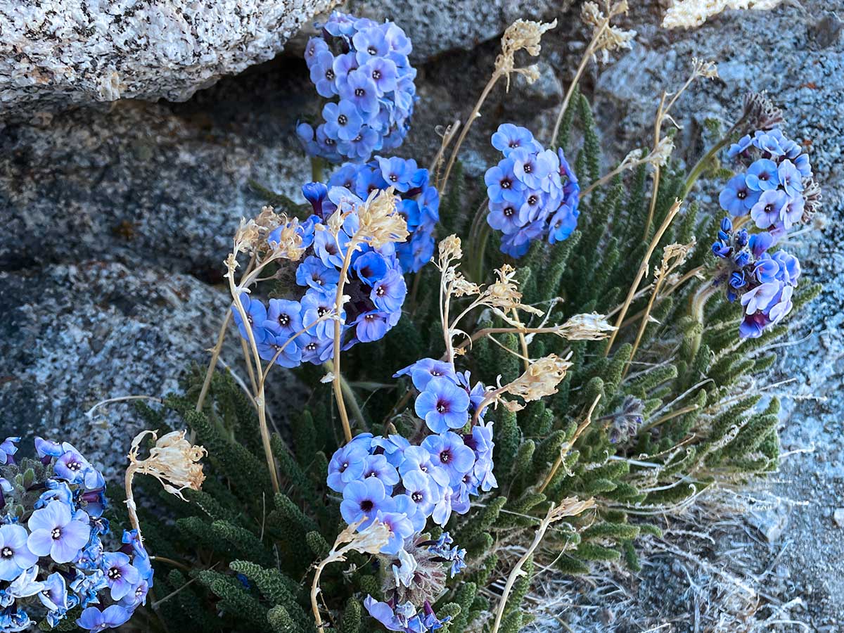
Skypilots
These are my favorite flower in the Sierra, skypilot (Polemonium eximium). They only grow above 10,000 feet and sightings are rare. I've only seen them above 13,000 feet in the Sierra and I was happy to see these on the way to the summit of Mt. Langley.
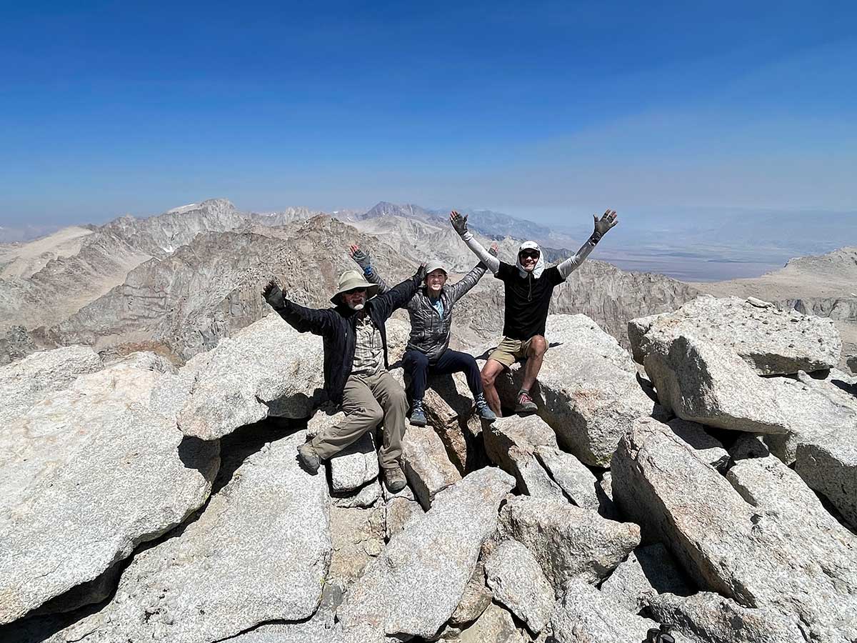
On the summit!
Success! After a bad night's sleep for all of us and an alpine start, we reached the summit around 11:30 am. Mt. Whitney is the highest peak in the background on the left. You can also see a layer of smoke from a large wildfire south of us. From here we only had a 4,927 foot descent and 11.2 miles of walking back to the trailhead...you can bet that we enjoyed a big dinner and a soak in the hot tub at our hotel in Lone Pine that night!