A Brief History of Cooley Landing
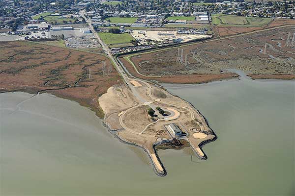
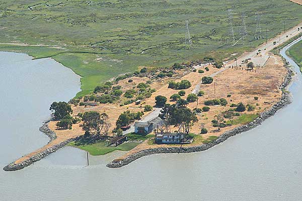
As an artist, I am interested in how a landscape changes over time and the environmental implications of those changes. This is a birds-eye view of Cooley Landing today. However, this peninsula of land didn't always exist.
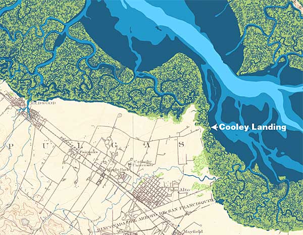
200 years ago, the area was lush wetlands, as shown in this historical map.
[image courtesy of the Oakland Museum of CA and SFEI]
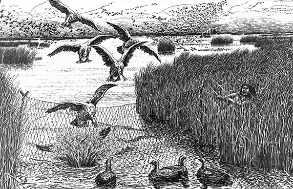
It was a favorite hunting and fishing spot for the native tribes. There were so many birds that the sky would be almost black with them and they could be caught with a net.
[photo from "The Ohlone Way" Heyday Books]
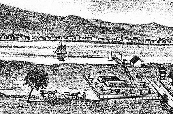
Big changes began during the Gold Rush when it became a shipping port. In 1867, Lester Cooley purchased the land and it became known as Cooley Landing. From 1874 - 1884, a brickworks factory operated at Ravenswood (now Jack Farrell Park). This illustration shows two field kilns and eight pub mills in the yard with Cooley’s Landing on the bayshore where schooners transported bricks to San Francisco to build the Palace Hotel.

The biggest changes happened from 1932 to 1960 when the land was filled by the San Mateo County dump, forming the peninsula we know today as Cooley Landing. Unfortunately this filled in valuable wetlands and contaminated the soil with lead, mercury, PCBs and other toxins.
[Image from "Over Time Palo Alto 1947 - 1980" by Ben Hatfield. Photo by Adrian Hatfield]
In 1960 Carl Schoof purchased the land and operated Palo Alto Boat Works until 1998. The boat lift is still on site.
[Photo courtesy of Jitze Couperous].