Temporary Land Art Installation at Cooley Landing
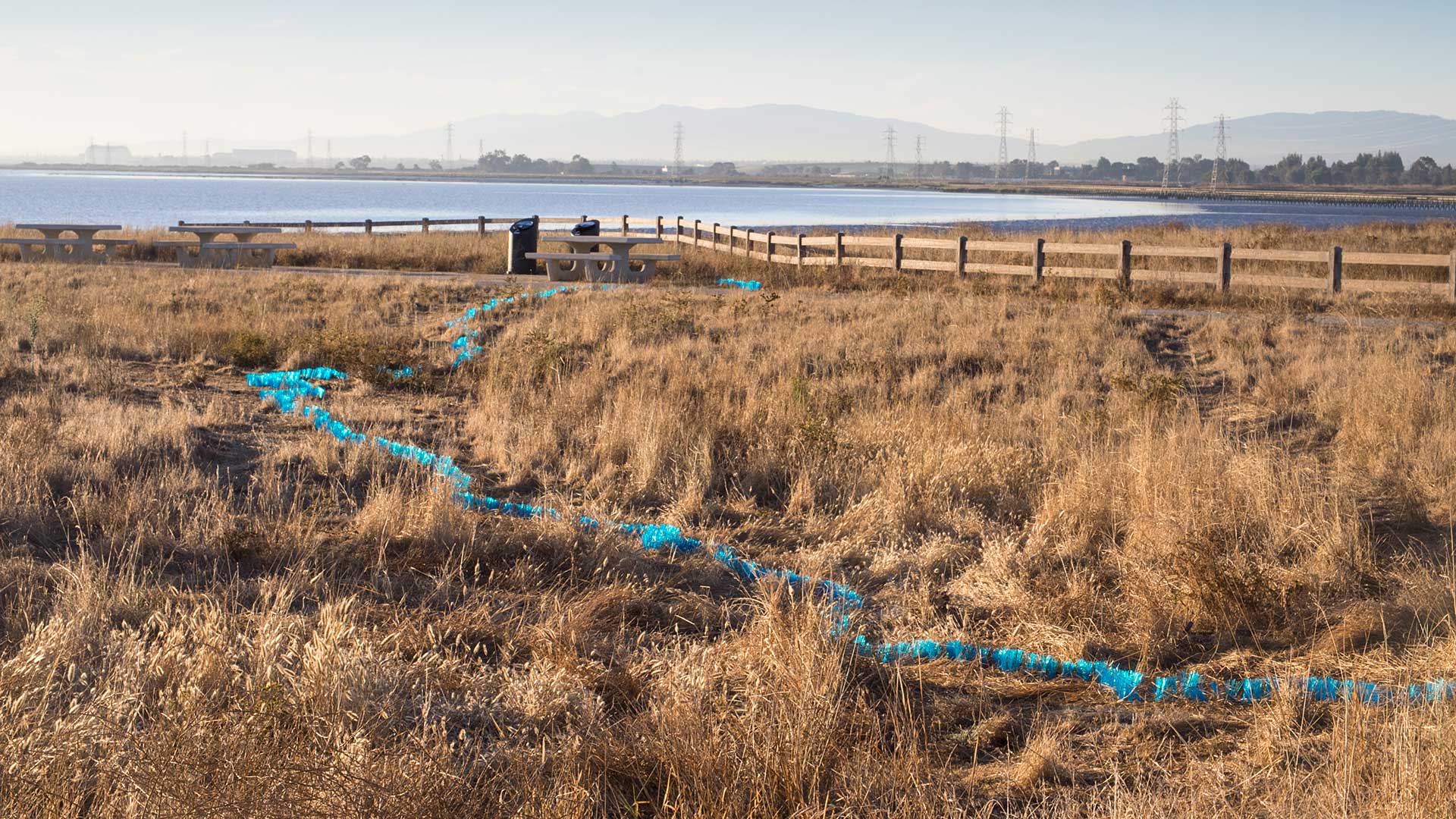
Cooley Landing is an artificial peninsula of land formed by garbage landfill. From 1930 - 1960, the county of San Mateo dumped and incinerated their refuse here. Using the United States Coastal Survey Map of San Francisco Bay from 1857 and a current satellite image, I was able to approximate where the historic shoreline of the bay once was on the present landscape of Cooley Landing. I then invited the community to participate in creating a temporary land art installation marking that historic shoreline using over 2,000 blue plastic survey whiskers.
Materials: Blue plastic survey whiskers and 5" nails, hammered in place.
Exhibition History: Installation on display at Cooley Landing July 2015 - December 2016. Photographs on display Nov 2015 - Jan 2016, Palo Alto Art Center, Palo Alto, CA and April 2017 - present, Cooley Landing Education Center, East Palo Alto, CA.
Photo credit: Joel Bartlett
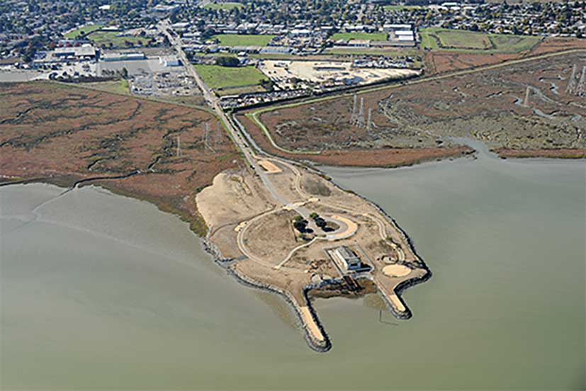
Cooley Landing - A Landscape Transformed Through Time
This is a photograph of Cooley Landing today. This peninsula of land didn't always exist.
Photo credit: Center for Land Use Interpretation.
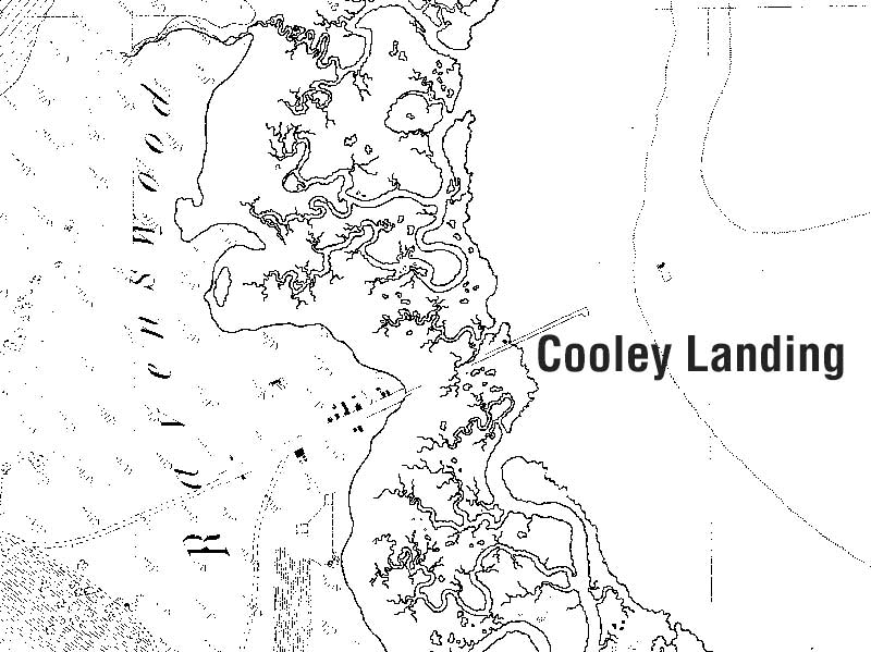
United States Coastal Survey Map, 1857
Originally this part of the bay was all wetlands. A historical map from the 1857 United States Coastal Survey shows the extensive wetlands as well as the pier that was the original Cooley Landing. This active shipping port transported oysters, lumber and bricks to San Francisco.
(Map is from the San Francisco Estuary Institute t-sheets.)
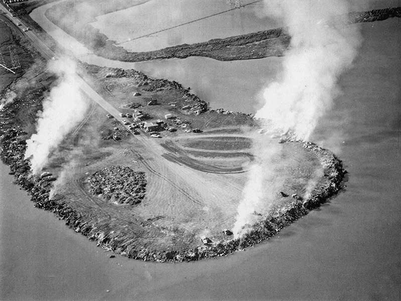
A Peninsula Made From Garbage
From 1930 – 1960, Cooley Landing was the site of the San Mateo County Dump. The peninsula of land that is now Cooley Landing is made from garbage landfill.
Photo credit: Adrian Hatfield
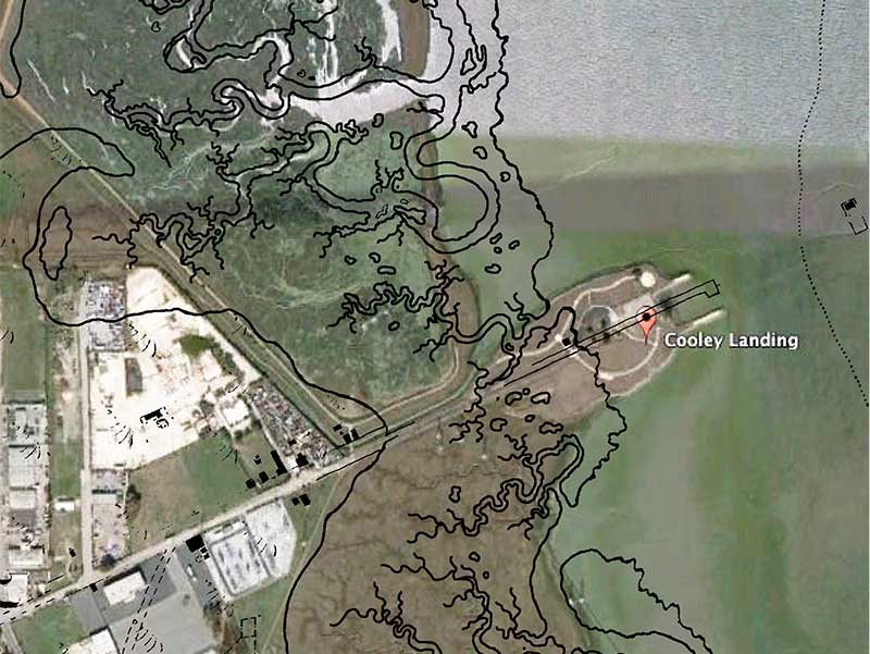
Overlay of historical map on top of present day Cooley Landing satellite image
I placed the historical coastal survey map over a recent Google Earth image of Cooley Landing to determine where the former shoreline was relative to present day features.
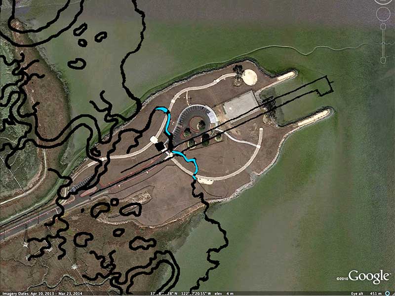
Plan for temporary Land Art installation
I then marked out an area to place the installation (shown in blue), avoiding areas that are off-limits to the pubic. The plan was to use blue survey whiskers to identify the former shoreline in the landscape at Cooley Landing.
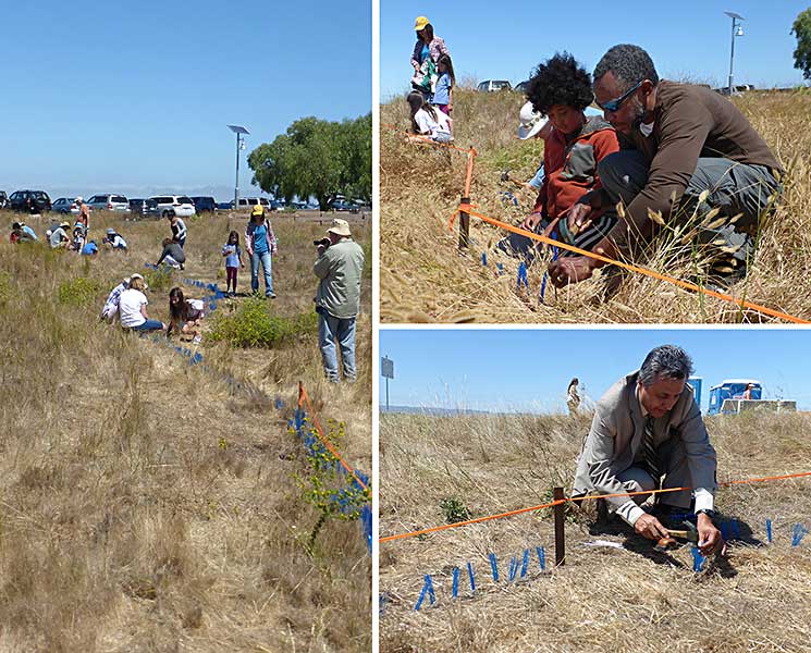
Engaging the Community to create the installation
Everyone in the local community was invited to participate in helping to create this installation, built over 6 different days in July 2015. People of all ages from East Palo Alto and surrounding communities participated in hammering in the blue survey markers.
Community members of all ages creating the installation
Documentary video by Herb Moore about the "in-the-field" part of my Creative Ecology Art+Science Residency highlighting the art and science activities we did outside at Cooley Landing. The original video was created to run as a silent loop during the exhibition of my work and Herb added his own music later. This is the version with his music from his album H2Overture.
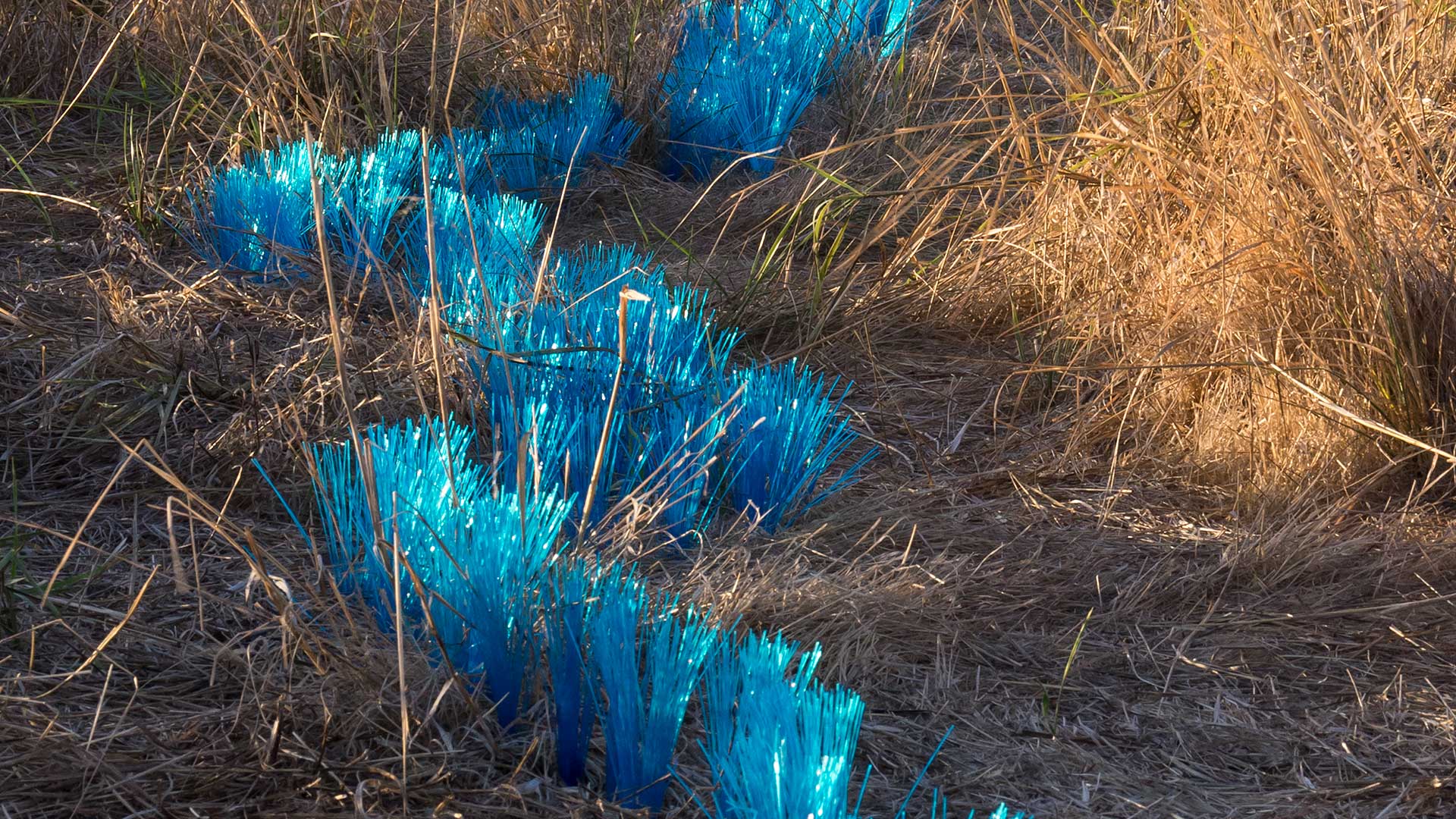
Close-up View of the temporary Land Art Installation at Cooley Landing
This is a close-up view of one section of the finished installation. Thank you for scrolling to the end!
Photo credit: Joel Bartlett